Category:Cape Agulhas
headland in the Western Cape, South Africa, the southernmost point of mainland Africa  | |||||
| Upload media | |||||
| Instance of | |||||
|---|---|---|---|---|---|
| Location | Cape Agulhas Local Municipality, Overberg District Municipality, Western Cape, RSA | ||||
| Located in or next to body of water | |||||
| Elevation above sea level |
| ||||
 | |||||
Deutsch: Kap Agulhas ist der südlichste Punkt des afrikanischen Kontinents und stellt die geografische Grenze zwischen Atlantischem und Indischem Ozean dar.
English: Cape Agulhas is the geographic southern tip of the African continent, and is defined for hydrographic purposes to be the dividing line between the Atlantic and Indian oceans.
Subcategories
This category has the following 5 subcategories, out of 5 total.
Media in category "Cape Agulhas"
The following 30 files are in this category, out of 30 total.
-
 Cape Agulhas, South Africa (ASTER), Suiderstrand & Struisbaai.jpg 963 × 602; 91 KB
-
 Cape Agulhas, South Africa (ASTER).jpg 2,763 × 1,493; 561 KB
-
 Cape Agulhas.jpg 2,592 × 1,944; 845 KB
-
 ISS-47 South Africa, Cape Town.jpg 4,928 × 3,280; 3.65 MB
-
 ISS006-E-14702 - View of South Africa.jpg 3,032 × 2,009; 1.19 MB
-
 Overberg topographic map.svg 1,300 × 750; 6.53 MB
-
 Riviersonderend map.svg 553 × 310; 1.96 MB
-
 South Africa extremes.jpg 580 × 766; 245 KB
-
 Admiralty Chart No 1013 Africa west coast Cape Lopez to Cape of Good Hope, Published 1887.jpg 8,725 × 15,127; 12.31 MB
-
 Admiralty Chart No 2082 Africa south coast Table Bay to Cape Agulhas, Published 1867.jpg 12,294 × 8,164; 13.06 MB
-
 Admiralty Chart No 2083 Africa south coast sheet 2 Cape Agulhas to Mossel Bay, Published 1867.jpg 12,267 × 8,217; 10.12 MB
-
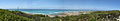 Aghulas panoramic.jpg 5,435 × 940; 1.1 MB
-
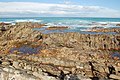
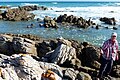
 Agulhas rocks.jpg 2,850 × 2,047; 6.6 MB
-
 Cape Agulhas - na Střelkovém mysu - panoramio.jpg 4,928 × 3,264; 16.38 MB
-
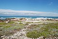
 Cape Agulhas panorama.jpg 8,453 × 960; 1.09 MB
-
 Cape Agulhas, South Africa (3225121449).jpg 3,008 × 2,000; 2.76 MB
-
 Cape Agulhas, South Africa (3225123943).jpg 3,008 × 2,000; 3.06 MB
-
 Cape Agulhas, South Africa (3225131171).jpg 3,008 × 2,000; 2.92 MB
-
 Cape Agulhas, South Africa (3225142651).jpg 3,008 × 2,000; 3.19 MB
-
 Cape Agulhas, South Africa (3225978830).jpg 3,008 × 2,000; 2.39 MB
-
 Cape Agulhas, South Africa (3225986334).jpg 3,008 × 2,000; 2.89 MB
-
 Cape Agulhas, South Africa (3225989616).jpg 3,008 × 2,000; 2.94 MB
-
 Cape Agulhas, South Africa (3225991064).jpg 3,008 × 2,000; 3.24 MB
-
 Cape Agulhas, South Africa (3225996586).jpg 3,008 × 2,000; 2.92 MB
-
 Cape Agulhas, South Africa (3226069060).jpg 3,008 × 2,000; 2.99 MB
-
 Container ship south of Agulhas.jpg 5,234 × 3,489; 3.01 MB
-
 Kap Agulhas Küste.JPG 750 × 500; 241 KB
-
 Khoisan.JPG 1,536 × 1,023; 1.46 MB
-
 Meisho Maru.jpg 4,048 × 3,036; 1.89 MB
-
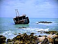
 Shipwreck In Cape Agulhas.jpg 1,200 × 800; 447 KB
,_Suiderstrand_%26_Struisbaai.jpg)
.jpg)


.jpg)
.jpg)
.jpg)
.jpg)
.jpg)
.jpg)
.jpg)
.jpg)
.jpg)
.jpg)


