Category:Derry
City in Northern Ireland    | |||||
| Upload media | |||||
| Instance of |
| ||||
|---|---|---|---|---|---|
| Location |
| ||||
| Located in or next to body of water | |||||
| Legislative body |
| ||||
| Significant event | |||||
| Population |
| ||||
| Area |
| ||||
| Different from | |||||
| official website | |||||
 | |||||
Subcategories
This category has the following 21 subcategories, out of 21 total.
B
C
D
F
- Flags in Derry (14 F)
G
H
- Heraldry of Derry (7 F)
M
P
- Plaques in Derry (22 F)
S
- Samderry (ship, 1944) (2 F)
- Signs in Derry (21 F)
T
W
Pages in category "Derry"
The following 2 pages are in this category, out of 2 total.
Media in category "Derry"
The following 200 files are in this category, out of 290 total.
(previous page) (next page)-
 "The Relief of Derry" mural, Derry - Londonderry - geograph.org.uk - 6160336.jpg 1,024 × 781; 281 KB
-
 3 clovers.jpg 2,304 × 3,072; 1.1 MB
-
 A plat of the lands belonging to the Company of Goldsmiths (27114684884).jpg 5,331 × 4,420; 8.94 MB
-
 A view of Londonderry.png 725 × 626; 471 KB
-
 Abbey, St Columb's Park, Derry - Londonderry (geograph 2486270).jpg 640 × 480; 100 KB
-
 Abercorn Road, Derry - Londonderry - geograph.org.uk - 6161576.jpg 1,024 × 685; 423 KB
-
 Agri Chem.jpg 2,717 × 1,239; 1.87 MB
-
 Along Foyle Street, Derry - Londonderry - geograph.org.uk - 6159668.jpg 1,024 × 685; 528 KB
-
 Amelia Earhart at Derry (6423929689).jpg 580 × 425; 63 KB
-
 Anchor bolt - panoramio.jpg 2,560 × 1,920; 3.16 MB
-
 Anchor, Derry - Londonderry - geograph.org.uk - 2794484.jpg 640 × 480; 59 KB
-
 Ancient Graveyard - geograph.org.uk - 389419.jpg 640 × 480; 208 KB
-
 Apartment Block, Derry - Londonderry - geograph.org.uk - 1797939.jpg 640 × 480; 44 KB
-
-
 At Columbs park - panoramio.jpg 1,536 × 2,310; 991 KB
-
 Austin's, Derry - Londonderry - geograph.org.uk - 3786435.jpg 640 × 480; 55 KB
-
 Baldies Barbers, Derry - Londonderry - geograph.org.uk - 5849267.jpg 1,024 × 685; 209 KB
-
 Banana Split - panoramio.jpg 4,000 × 6,016; 4.43 MB
-
 Barrack Street, Derry - Londonderry - geograph.org.uk - 6161588.jpg 1,024 × 685; 421 KB
-
 Bench Mark 3338, Derry - Londonderry - geograph.org.uk - 1795267.jpg 2,560 × 1,920; 1.82 MB
-
 Bloody Sunday (42115909521).jpg 3,024 × 4,032; 2.59 MB
-
 Bloody Sunday Memorial (40308763110).jpg 4,412 × 2,760; 3.05 MB
-
 Bluebird ^ me - Claudes, Derry - Londonderry - geograph.org.uk - 5849271.jpg 1,024 × 748; 272 KB
-
 Bogside (27245345257).jpg 7,346 × 3,514; 8.63 MB
-
 Bogside (41395616324).jpg 5,472 × 3,648; 4.42 MB
-
 Bogside (41395711444).jpg 5,472 × 3,648; 4.56 MB
-
 Bogside and City Walls - Derry, Northern Ireland, UK - August 17, 2017.jpg 15,108 × 7,026; 54.02 MB
-
 Bogside Inn, Derry - Londonderry - geograph.org.uk - 6161631.jpg 1,024 × 685; 427 KB
-
 Bogside Murals - Bernadette Devlin - geograph.org.uk - 5558803.jpg 640 × 481; 585 KB
-
-
 Busty's, Derry - Londonderry - geograph.org.uk - 5849254.jpg 1,024 × 685; 187 KB
-
 Busy Pubs (28242753838).jpg 4,201 × 2,889; 2.34 MB
-
 Castle Street, Derry - Londonderry - geograph.org.uk - 5849260.jpg 1,024 × 685; 193 KB
-
 Cathedral Youth Club, Derry - Londonderry - geograph.org.uk - 6161197.jpg 1,024 × 685; 466 KB
-

-
 Charlotte Street, Derry - Londonderry - geograph.org.uk - 6161594.jpg 1,024 × 685; 469 KB
-
 Cherym-Latitude-Festival-2021-EDITED.jpg 2,500 × 1,666; 1.34 MB
-
 China Garden - Cappuccinos, Derry - Londonderry - geograph.org.uk - 6159645.jpg 1,024 × 755; 220 KB
-
 City walls, Derry - Londonderry - geograph.org.uk - 6160252.jpg 1,024 × 685; 426 KB
-
 City walls, Derry - Londonderry - geograph.org.uk - 6161626.jpg 1,024 × 685; 523 KB
-
 Clock tower, Derry-Londonderry - geograph.org.uk - 2199680.jpg 3,216 × 4,288; 3.55 MB
-
 Coat of Arms, Derry City Council - geograph.org.uk - 1797946.jpg 2,584 × 1,672; 707 KB
-
 Colin Davidson.png 202 × 202; 89 KB
-
 Colourful railings, Derry - Londonderry - geograph.org.uk - 6160329.jpg 1,024 × 685; 527 KB
-
 Competitors, Foyle Cup - geograph.org.uk - 5845113.jpg 1,024 × 685; 211 KB
-
 Craigavon Bridge - geograph.org.uk - 7105718.jpg 1,024 × 684; 157 KB
-
 Craigavon Bridge - geograph.org.uk - 7105721.jpg 1,024 × 684; 129 KB
-
 Craigavon Bridge, Derry - geograph.org.uk - 8169783.jpg 2,606 × 1,965; 1.1 MB
-

-

-
 Crest, Spencer Road (1) - geograph.org.uk - 1797824.jpg 640 × 480; 55 KB
-
 Crest, Spencer Road (2) - geograph.org.uk - 1797826.jpg 640 × 480; 59 KB
-
 Crest, Spencer Road (3) - geograph.org.uk - 1797829.jpg 640 × 480; 52 KB
-
 Crest, Spencer Road (4) - geograph.org.uk - 1797830.jpg 640 × 480; 32 KB
-
 Crest, Spencer Road (5) - geograph.org.uk - 1797831.jpg 640 × 480; 33 KB
-
 Crest, Spencer Road (6) - geograph.org.uk - 1797836.jpg 640 × 480; 35 KB
-
 Crest, Spencer Road (7) - geograph.org.uk - 1797840.jpg 640 × 480; 34 KB
-
 Crowds at Shipquay Place, Derry - Londonderry - geograph.org.uk - 5845110.jpg 1,024 × 685; 299 KB
-
 Cutting grass, Derry - Londonderry - geograph.org.uk - 6160333.jpg 1,024 × 685; 501 KB
-
 Dawson Hinds, Derry - Londonderry - geograph.org.uk - 2794446.jpg 640 × 480; 55 KB
-
-
-
 Derry - Londonderry - geograph.org.uk - 6160257.jpg 1,024 × 685; 467 KB
-
 Derry 1993 blank.svg 411 × 493; 231 KB
-
 Derry 1993 Cityside highlight.svg 411 × 493; 231 KB
-
 Derry 1993 Northland highlight.svg 411 × 493; 231 KB
-
 Derry 1993 Rural highlight.svg 411 × 493; 231 KB
-
 Derry 1993 Shantallow highlight.svg 411 × 493; 231 KB
-
 Derry 1993 Waterside highlight.svg 411 × 493; 231 KB
-
 Derry 2001 election.svg 1,156 × 851; 256 KB
-
 Derry 2017-04-01-1.jpg 4,832 × 3,141; 5.6 MB
-
 Derry 2017-04-01-2.jpg 4,846 × 3,247; 5.38 MB
-
 Derry at night - panoramio.jpg 3,264 × 2,448; 2.93 MB
-
 Derry City Council Mayor addresses the crowd - geograph.org.uk - 5845121.jpg 1,024 × 685; 180 KB
-
-
 Derry city Walls, Grand Parade - geograph.org.uk - 5558842.jpg 481 × 640; 586 KB
-
 Derry city Walls, The Double Bastion - geograph.org.uk - 5558831.jpg 640 × 430; 405 KB
-
 Derry Crest.pdf 904 × 1,077; 3.55 MB
-
 Derry Guildhall and Peace Bridge - geograph.org.uk - 5558922.jpg 640 × 482; 411 KB
-
 Derry Panorama.jpg 640 × 208; 29 KB
-
 Derry Tourist Information Centre - geograph.org.uk - 5558584.jpg 640 × 480; 470 KB
-
 Derry Twilight - HDR (9334796544).jpg 1,800 × 1,200; 1.89 MB
-
 Derry Waterfront - geograph.org.uk - 2166.jpg 640 × 480; 40 KB
-
 Derry, Ireland 1607.jpg 650 × 433; 225 KB
-
 Derry, The Bogside - geograph.org.uk - 5558735.jpg 640 × 480; 378 KB
-

-
 DerryMontage3.JPG 727 × 1,217; 346 KB
-

-
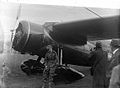
 Downtown Londonderry, 1943 (16656252408).jpg 1,246 × 719; 81 KB
-
 Drive 105, Derry - Londonderry - geograph.org.uk - 1797868.jpg 640 × 480; 53 KB
-
 Dublin Aircoach LDerry bus stop.jpg 2,478 × 3,192; 978 KB
-
 DV405 no.231 Londonderry.png 1,363 × 1,115; 4.36 MB
-
 Ebrington Barracks, Londonderry - geograph.org.uk - 3328428.jpg 3,648 × 2,736; 4.77 MB
-
 Ebrington Square (42069685242).jpg 16,382 × 3,700; 12.48 MB
-
 Entrance, The Craft Village, Derry - Londonderry - geograph.org.uk - 5849277.jpg 1,024 × 753; 271 KB
-
 Flock of birds, Derry - Londonderry - geograph.org.uk - 5845127.jpg 1,024 × 685; 172 KB
-
 Fountain Area, Derry - Londonderry - geograph.org.uk - 6161195.jpg 1,024 × 742; 160 KB
-
 Fountain Area, Derry - Londonderry - geograph.org.uk - 6161238.jpg 1,024 × 685; 450 KB
-
 Fountain Hill, Derry - Londonderry - geograph.org.uk - 1797878.jpg 640 × 480; 58 KB
-
 Fountain Street, Derry - Londonderry - geograph.org.uk - 6160260.jpg 1,024 × 685; 450 KB
-
 Foyle Road, Londonderry - Derry - geograph.org.uk - 4780172.jpg 1,200 × 799; 312 KB
-
 Foyle Road, Londonderry - Derry - geograph.org.uk - 4780179.jpg 1,200 × 799; 308 KB
-

-
 Foyleside Shopping Centre, Derry - Londonderry - geograph.org.uk - 6160259.jpg 1,024 × 685; 487 KB
-
 Garden Pond - geograph.org.uk - 473486.jpg 640 × 480; 176 KB
-

-
 George's Bar, Derry - Londonderry - geograph.org.uk - 6161245.jpg 1,024 × 685; 437 KB
-
 Georges Street, Derry - Londonderry - geograph.org.uk - 6160347.jpg 1,024 × 685; 463 KB
-
 Guildhall Square, Derry - geograph.org.uk - 5805916.jpg 2,000 × 1,500; 732 KB
-
-
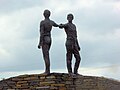 Hands Across the Divide - geograph.org.uk - 5683673.jpg 640 × 480; 313 KB
-
 Hawkin Street, Derry - Londonderry - geograph.org.uk - 6160309.jpg 1,024 × 685; 450 KB
-
 Henry Estate Agents - Taste - geograph.org.uk - 1797911.jpg 640 × 480; 51 KB
-
 Henry Street, Derry - Londonderry - geograph.org.uk - 6161192.jpg 1,024 × 711; 172 KB
-
 HMS Wivern (1919).jpg 8,030 × 5,115; 5.02 MB
-
 Home Tech, Derry - Londonderry - geograph.org.uk - 5849280.jpg 1,024 × 740; 259 KB
-
-
-
 Houses in the bright sunlight - panoramio.jpg 2,560 × 1,920; 3.29 MB
-
 Houses on York Street - geograph.org.uk - 7007210.jpg 1,024 × 768; 122 KB
-
 Housing Executive Offices, Derry - Londonderry - geograph.org.uk - 6160263.jpg 1,024 × 685; 426 KB
-

-
 Iona Inn B ^ B, Derry - Londonderry - geograph.org.uk - 1797936.jpg 640 × 480; 44 KB
-
 Irish Nationl road sign for Derry.jpg 3,888 × 2,592; 3.27 MB
-
 Irlanda del Nord - Derry Londonderry The Peace Bridge e Guildhall.jpg 4,592 × 3,448; 3.01 MB
-
 Journal of the Royal Society of Antiquaries of Ireland (1915) (14780168624).jpg 1,756 × 2,676; 499 KB
-
 Journal of the Royal Society of Antiquaries of Ireland (1915) (14782175182).jpg 2,240 × 1,284; 346 KB
-
 Metropolitan Visitation of the Diocese of Derry, A.D. 1397- No. 2 (IA jstor-20563461).pdf 975 × 1,500, 15 pages; 2.52 MB
-
 KC Restaurant, Derry - Londonderry - geograph.org.uk - 6162063.jpg 1,024 × 685; 498 KB
-
 Kells Walk, Irish Republican Army (28243012178).jpg 3,876 × 2,317; 2.08 MB
-
 Kennedy Street, Derry - Londonderry - geograph.org.uk - 6160320.jpg 1,024 × 685; 454 KB
-
 Kennedy Street, Derry - Londonderry - geograph.org.uk - 6160321.jpg 1,024 × 760; 185 KB
-
 Kennedy Street, Derry - Londonderry - geograph.org.uk - 6160324.jpg 1,024 × 715; 145 KB
-
 Leaving a message, Derry - Londonderry - geograph.org.uk - 4391468.jpg 640 × 480; 188 KB
-
 Lecky Road, Derry - Londonderry - geograph.org.uk - 6161618.jpg 1,024 × 686; 536 KB
-
 Letterkenny Road at Brae Head Road - geograph.org.uk - 4780215.jpg 1,200 × 799; 312 KB
-
 Letterkenny Road towards Killea - geograph.org.uk - 4780220.jpg 1,200 × 799; 288 KB
-
 Library, Derry - Londonderry - geograph.org.uk - 6159656.jpg 1,024 × 685; 485 KB
-
 Link road, Derry - Londonderry - geograph.org.uk - 2794456.jpg 640 × 480; 43 KB
-
 Link road, Derry - Londonderry - geograph.org.uk - 2794467.jpg 640 × 480; 49 KB
-
 Link road, Derry - Londonderry - geograph.org.uk - 2794469.jpg 640 × 480; 43 KB
-
 London Street, Derry - Londonderry - geograph.org.uk - 6160268.jpg 1,024 × 685; 444 KB
-

-
 Londonderry - panoramio.jpg 2,272 × 1,704; 2.14 MB
-
 Londonderry and Enniskillen Railway - geograph.org.uk - 3053502.jpg 640 × 480; 344 KB
-
 Londonderry and Enniskillen Railway - geograph.org.uk - 3255126.jpg 640 × 376; 216 KB
-
 Londonderry Dusk.jpg 1,024 × 768; 140 KB
-
 Londonderry flag.png 1,280 × 720; 339 KB
-
 Londonderry flag.svg 1,700 × 960; 87 KB
-

-
 Londonderry skyline - geograph.org.uk - 750845.jpg 640 × 425; 68 KB
-
 Londonderry05.jpg 3,456 × 2,304; 2.15 MB
-
 Long Tower Primary School, Derry - Londonderry - geograph.org.uk - 6161249.jpg 1,024 × 685; 441 KB
-
 Magazine Street - geograph.org.uk - 5849266.jpg 1,024 × 718; 215 KB
-
 Magazine Street, Derry - Londonderry - geograph.org.uk - 5849263.jpg 1,024 × 685; 184 KB
-
 Mall (5020711029).jpg 2,560 × 1,920; 2.17 MB
-
 Manhole Cover, Derry - Londonderry - geograph.org.uk - 1553348.jpg 640 × 480; 87 KB
-
 Map showing the traditional, geographical county of County Londonderry, Northern Ireland.png 4,967 × 4,967; 3.26 MB
-
 MargoHarkin JamesNash.jpg 2,544 × 1,696; 1.34 MB
-

-
 Metal sculpture, Derry - Londonderry - geograph.org.uk - 6161233.jpg 1,024 × 685; 456 KB
-

-
 Millennium Milepost at Derry - geograph.org.uk - 5560925.jpg 640 × 481; 337 KB
-

-
 Mural George's Bar, Derry - Londonderry - geograph.org.uk - 6161247.jpg 1,024 × 685; 426 KB
-
 Mural, Derry - Londonderry - geograph.org.uk - 8206828.jpg 1,024 × 769; 191 KB
-
 Mural, Derry-Londonderry - geograph.org.uk - 6195579.jpg 1,024 × 649; 260 KB
-
 Nailors Row, Derry - Londonderry - geograph.org.uk - 6161243.jpg 1,024 × 685; 486 KB
-

-

-

-
 Night sky - panoramio (2).jpg 2,310 × 1,536; 1.1 MB
-
 Nonnas - Lunn's, Derry - Londonderry - geograph.org.uk - 5849276.jpg 1,024 × 724; 271 KB
-
 Northern Ireland Housing Executive Offices - geograph.org.uk - 5849259.jpg 1,024 × 701; 176 KB
-
 October Morn - geograph.org.uk - 595190.jpg 640 × 480; 30 KB
-
 Old propeller, Derry - Londonderry - geograph.org.uk - 2794495.jpg 640 × 480; 86 KB
-
 Ole Friele Backer jageren Newport.jpg 1,604 × 2,270; 964 KB
-
 Open area, Derry - Londonderry - geograph.org.uk - 8206833.jpg 1,024 × 768; 439 KB
-
 Orchard Street, Derry - Londonderry - geograph.org.uk - 6159673.jpg 1,024 × 787; 178 KB
-
 Orchard Street, Derry - Londonderry - geograph.org.uk - 6159675.jpg 1,024 × 685; 471 KB
-
 Orchard Street, Derry - Londonderry - geograph.org.uk - 6160249.jpg 1,024 × 685; 443 KB
-
 Park, Foyle Road - geograph.org.uk - 3053485.jpg 640 × 480; 323 KB
-

-
 Path, University of Ulster Grounds - geograph.org.uk - 1553335.jpg 640 × 480; 94 KB
-
 PB343570 0480 Londonderry 2014-05-13 HB5.3.jpg 808 × 330; 74 KB
-
 Peace Bridge and Guildhall, Derry - geograph.org.uk - 5864206.jpg 683 × 1,024; 150 KB
-
 Peace bridge Derry Londonderry.png 1,920 × 1,080; 2.83 MB
-
 Peace Bridge River Foyle (27245161497).jpg 11,996 × 3,738; 10.83 MB
-
 Peace Bridge River Foyle (42069610962).jpg 5,472 × 3,648; 3.9 MB
-
 Peace Bridge River Foyle (42115760691).jpg 14,000 × 3,688; 11.26 MB
-
 Peace mural in Derry Northern Ireland Broken Gun.jpg 512 × 911; 111 KB
-
 Plaque, Derry - Londonderry - geograph.org.uk - 6161231.jpg 1,024 × 685; 460 KB
-
 Plaque, St. Columba's Church, Long Tower - geograph.org.uk - 6161601.jpg 1,024 × 686; 430 KB
-
 Plaque, St. Columba's National Schools - geograph.org.uk - 6161606.jpg 1,024 × 812; 287 KB
-
 Prehen woods - panoramio.jpg 2,048 × 1,362; 706 KB
-
 Quayside walk, Derry - Londonderry - geograph.org.uk - 2794502.jpg 640 × 480; 38 KB
-
 Quayside, Derry - Londonderry - geograph.org.uk - 5845795.jpg 1,024 × 685; 193 KB
-

-
 Red Raven.jpg 3,024 × 4,032; 2.21 MB
-
 Red, white and blue, London Street - geograph.org.uk - 7458346.jpg 1,979 × 1,485; 755 KB


.jpg)

.jpg)


.jpg)


.jpg)
.jpg)

.jpg)
.jpg)
.jpg)


.jpg)


_-_geograph.org.uk_-_1797824.jpg)
_-_geograph.org.uk_-_1797826.jpg)
_-_geograph.org.uk_-_1797829.jpg)
_-_geograph.org.uk_-_1797830.jpg)
_-_geograph.org.uk_-_1797831.jpg)
_-_geograph.org.uk_-_1797836.jpg)
_-_geograph.org.uk_-_1797840.jpg)


.jpg)


.jpg)


.jpg)

_-_geograph.org.uk_-_6160265.jpg)
_-_geograph.org.uk_-_6160266.jpg)


_(14780168624).jpg)
_(14782175182).jpg)

.jpg)


_railway_station_(2)_-_geograph.org.uk_-_2763401.jpg)


.jpg)


_-_geograph.org.uk_-_1037565.jpg)
_-_geograph.org.uk_-_1037568.jpg)
.jpg)


.jpg)


.jpg)
.jpg)
.jpg)