Category:Gaspé Peninsula
peninsula in Québec, Canada .jpg)    | |||||
| Upload media | |||||
| Instance of | |||||
|---|---|---|---|---|---|
| Part of |
| ||||
| Named after | |||||
| Location | Quebec, Canada | ||||
| Located in or next to body of water |
| ||||
| Highest point |
| ||||
| Area |
| ||||
 | |||||
Subcategories
This category has the following 12 subcategories, out of 12 total.
A
B
C
G
H
M
- Maps of Gaspé Peninsula (16 F)
Q
- Quiaude (3 F)
R
- Rivière Cascapédia (8 F)
- Rivière Patapédia (2 F)
Media in category "Gaspé Peninsula"
The following 144 files are in this category, out of 144 total.
-
 - panoramio (5008).jpg 8,384 × 1,664; 1.8 MB
-
 (1885) p043 Cape Gaspe.jpg 1,597 × 1,625; 1.23 MB
-
 (1885) p048 Crossing the Ferry at Gaspe.jpg 1,370 × 1,155; 785 KB
-
 A rural highway in the Gaspe Penninsula, Quebec.jpg 3,063 × 2,079; 480 KB
-
 Basstölpel-Kolonie in Kanada.jpg 3,504 × 2,336; 4.53 MB
-
 Bulletin of the Geological Society of America (1920) (19829119323).jpg 2,068 × 1,336; 637 KB
-
 CapBonAmiVueDuBelvedere.jpg 3,456 × 5,184; 2.72 MB
-
 CascapediaRiver.jpg 4,032 × 2,268; 2.01 MB
-
 Caterpillar of bedstraw hawk-moth.jpg 2,988 × 5,312; 1.46 MB
-
 Chemin Lacroix.jpg 2,537 × 1,589; 1.37 MB
-
 Chicchoc1.jpg 640 × 480; 57 KB
-
 Chichoc2.jpg 640 × 480; 58 KB
-
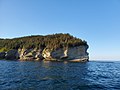
 Cliff in Gaspe - IMG 1304 (15584559606).jpg 5,472 × 3,648; 1.12 MB
-
 Cliffs in Gaspe - IMG 1284 (15422115618).jpg 3,648 × 5,472; 2.28 MB
-

-
 Etablissement d Henri Senechal a Saint-Gabriel-de-Gaspe - 1943.jpg 839 × 440; 131 KB
-
 Fishing Boat 9976 (34768141523).jpg 5,616 × 3,744; 11.73 MB
-
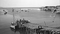
 Fishing Harbor (35189852770).jpg 5,616 × 3,744; 8.52 MB
-
 Fishing Harbor (35189856170).jpg 5,616 × 3,744; 9.23 MB
-
 Fishing Harbor (35577028395).jpg 5,616 × 3,744; 7.72 MB
-
 Fishing the River (34768136183).jpg 3,744 × 5,616; 9.82 MB
-
 Fishing the River (35577049205).jpg 3,744 × 5,616; 12.28 MB
-
 Flag of Gaspesie.svg 512 × 341; 4 KB
-
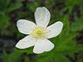 Fleur-en-Gaspésie.jpg 1,991 × 1,494; 892 KB
-
 Flower field (34768132013).jpg 5,616 × 3,744; 11.7 MB
-
 Fog In The Gaspe (46653434).jpeg 768 × 1,024; 164 KB
-
 GaspePeninsula23.jpg 300 × 271; 15 KB
-
 GaspePeninsulaRegions.jpg 1,135 × 599; 159 KB
-
 Gaspesie eau.jpg 2,048 × 1,536; 545 KB
-
 Gaspé taiga.jpg 3,072 × 2,304; 1.75 MB
-
 Gaspésie - vue.jpg 2,048 × 1,536; 513 KB
-
 Gaspésie 2004 edited.jpg 711 × 482; 56 KB
-
 Gaspésie 2004.jpg 1,280 × 960; 565 KB
-
 Gaspésie.jpg 1,363 × 1,022; 404 KB
-
 Hitchhicking on the road 132 - Gaspésie Canada.jpg 800 × 555; 87 KB
-
 Indian Head (Tête d’Indien).jpg 540 × 960; 59 KB
-
 Intimidation Sculpture (34735913694).jpg 5,616 × 3,744; 10.56 MB
-
 Intimidation Sculpture (35577025075).jpg 5,616 × 3,744; 9.51 MB
-
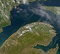
 ISS062-E-5685 - View of Earth.jpg 5,568 × 3,712; 3.55 MB
-
 ISS062-E-5686 - View of Earth.jpg 5,568 × 3,712; 3.55 MB
-
 J.C. Van Horne Bridge (35409032032).jpg 5,612 × 3,741; 9.04 MB
-
 Jardins de Métis, Quebec Canada.jpg 3,744 × 5,616; 7.09 MB
-
 La peche au saumon et a la truite en Gaspesie.jpg 601 × 424; 45 KB
-
 Le phare à Pointe Mitis, Métis-sur-Mer, vue panoramique.jpg 4,551 × 2,770; 4.6 MB
-
 Leucanthemum-vulgare crop.jpg 2,048 × 1,536; 979 KB
-
 Lighthouse (35577014235).jpg 3,253 × 4,754; 6.49 MB
-
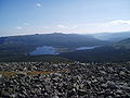
 Massifdeschicschocsdumonternestlaforce.jpg 1,292 × 969; 384 KB
-
 Moose sculpture 0077 (35577011495).jpg 5,616 × 3,744; 16.69 MB
-
 Moose sculpture 0078 (35446589691).jpg 5,616 × 3,744; 11.98 MB
-
 Pedestrian Bridge (35576990155).jpg 5,615 × 3,743; 8.93 MB
-
 Phare du Cap-Des-Rosiers.jpg 1,456 × 2,592; 722 KB
-
 Pico Falls, St-André-de-Restigouche (35189618960).jpg 5,616 × 3,744; 14.89 MB
-
 Pico Falls, St-André-de-Restigouche (35408790952).jpg 3,744 × 5,616; 20.14 MB
-
 Pico Falls, St-André-de-Restigouche (35446370911).jpg 3,563 × 5,208; 13.85 MB
-
 Pico Falls, St-André-de-Restigouche (35576791755).jpg 5,614 × 3,742; 13.61 MB
-
 Pico Falls, St-André-de-Restigouche (35576814805).jpg 5,590 × 3,704; 13.99 MB
-
 Plan of the district of Gaspé (4231299821).jpg 2,000 × 1,631; 2.94 MB
-
 Pointe Saint-Pierre - 1910.jpg 1,654 × 924; 161 KB
-
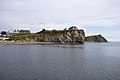
 Pointe Ste-Croix 9944-9946 (35538038136).jpg 5,613 × 3,741; 9.7 MB
-
 Pêcheur sur la Petite Cascapédia Est.jpg 1,536 × 1,152; 860 KB
-
 Reconstitution de l'intérieur d'un magasin général.png 636 × 423; 521 KB
-
 Renomme Pointe Lighthouse 0234 (35446468831).jpg 5,616 × 3,744; 11.21 MB
-
 Renomme Pointe Lighthouse 0235 (35538034556).jpg 5,616 × 3,744; 10.99 MB
-
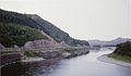 Restigouche River, Canada - (Summer 1993) (facing East).jpg 1,552 × 900; 189 KB
-
 River St Lawrence Matane 0345-0347 (35408836992).jpg 5,605 × 3,738; 13.24 MB
-
 Roche sous la forme d'une tête d'indien en Gaspésie.jpg 6,936 × 9,248; 6.11 MB
-
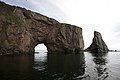
 Rocher Perce (34735799134).jpg 5,616 × 3,744; 13.18 MB
-
 Rocher Perce (34735806354).jpg 5,616 × 3,744; 14.29 MB
-
 Rocher Perce (34735812954).jpg 5,616 × 3,744; 12.7 MB
-
 Rocher Perce (34735827004).jpg 5,616 × 3,744; 9.94 MB
-
 Rocher Perce (34735830224).jpg 5,616 × 3,744; 8.62 MB
-
 Rocher Perce (34735844294).jpg 5,387 × 3,686; 8.23 MB
-
 Rocher Perce (34735846804).jpg 5,616 × 3,744; 8.62 MB
-
 Rocher Perce (34735849834).jpg 5,616 × 3,744; 12.75 MB
-
 Rocher Perce (34735852534).jpg 5,616 × 3,744; 14.36 MB
-
 Rocher Perce (34768007763).jpg 5,616 × 3,744; 9.83 MB
-
 Rocher Perce (34768010733).jpg 5,256 × 3,596; 10.09 MB
-
 Rocher Perce (35189775580).jpg 5,616 × 3,744; 10.31 MB
-
 Rocher Perce (35189779390).jpg 5,616 × 3,744; 13.8 MB
-
 Rocher Perce (35189783110).jpg 5,616 × 3,744; 9.14 MB
-
 Rocher Perce (35189786960).jpg 5,234 × 3,581; 7.84 MB
-
 Rocher Perce (35189793860).jpg 5,616 × 3,744; 8.7 MB
-
 Rocher Perce (35189802090).jpg 5,616 × 3,744; 9.18 MB
-
 Rocher Perce (35408923472).jpg 900 × 250; 223 KB
-
 Rocher Perce (35446473091).jpg 5,616 × 3,744; 14.89 MB
-
 Rocher Perce (35446488481).jpg 5,616 × 3,744; 12.41 MB
-
 Rocher Perce (35446494951).jpg 5,616 × 3,744; 14.76 MB
-
 Rocher Perce (35446500471).jpg 5,616 × 3,744; 13.46 MB
-
 Rocher Perce (35446505901).jpg 5,616 × 3,744; 9.14 MB
-
 Rocher Perce (35446512061).jpg 5,616 × 3,744; 11.91 MB
-
 Rocher Perce (35446544131).jpg 5,616 × 3,744; 10.31 MB
-
 Rocher Perce (35446552021).jpg 5,616 × 3,744; 10.81 MB
-
 Rocher Perce (35446561591).jpg 5,616 × 3,744; 12.47 MB
-
 Rocher Perce (35446574011).jpg 5,616 × 3,744; 12.94 MB
-
 Rocher Perce (35446576671).jpg 5,616 × 3,744; 9.93 MB
-
 Rocher Perce (35538045756).jpg 5,616 × 3,744; 30.73 MB
-
 Rocher Perce (35538048376).jpg 3,744 × 5,616; 11.94 MB
-
 Rocher Perce (35538068476).jpg 5,616 × 3,744; 9.97 MB
-
 Rocher Perce (35538071786).jpg 5,293 × 3,622; 9.65 MB
-
 Rocher Perce (35576903165).jpg 5,616 × 3,744; 13.15 MB
-
 Rocher Perce (35576908485).jpg 5,616 × 3,744; 12.76 MB
-
 Rocher Perce (35576914215).jpg 5,616 × 3,744; 9.28 MB
-
 Rocher Perce (35576946395).jpg 5,616 × 3,744; 10.14 MB
-
 Rocher Perce (35576951445).jpg 5,616 × 3,744; 11.88 MB
-
 Rocher Perce (35576981425).jpg 5,616 × 3,744; 13.15 MB
-
 Rocher Perce (35576986205).jpg 5,616 × 3,744; 8.28 MB
-
 Sail Boat Towed 0283 (34735750514).jpg 5,616 × 3,744; 14.56 MB
-
 Salmon river (34735752444).jpg 5,615 × 3,743; 8.94 MB
-
 Salmon river (34735755484).jpg 5,616 × 3,744; 10.52 MB
-
 Salmon river (34735761794).jpg 5,616 × 3,744; 11.43 MB
-
 Salmon river (34767953493).jpg 5,616 × 3,744; 10.63 MB
-
 Salmon river (35189942050).jpg 5,616 × 3,744; 9.6 MB
-
 Salmon river (35189945080).jpg 5,616 × 3,744; 11.3 MB
-
 Salmon river (35408912792).jpg 5,616 × 3,744; 12.29 MB
-
 Salmon river (35538031146).jpg 5,616 × 3,744; 9.24 MB
-
 Salmon river (35577042345).jpg 5,616 × 3,744; 12.65 MB
-
 Seascape (34735731344).jpg 5,609 × 3,740; 21.16 MB
-
 Seascape (34767909103).jpg 5,616 × 3,744; 10.45 MB
-
 Seascape (35408849612).jpg 5,616 × 3,744; 8.84 MB
-
 Seascape (35408852562).jpg 5,616 × 3,744; 7.69 MB
-
 Seascape (35408856322).jpg 5,616 × 3,744; 14.81 MB
-
 Seascape (35408858912).jpg 5,616 × 3,744; 9.78 MB
-
 Seascape (35446414861).jpg 5,616 × 3,744; 12.25 MB
-
 Seascape (35446418951).jpg 5,616 × 3,744; 10.83 MB
-
 Seascape (35446421781).jpg 5,195 × 3,554; 8.66 MB
-
 Seascape (35446428221).jpg 3,741 × 5,613; 9.16 MB
-
 Seascape (35446432531).jpg 3,740 × 5,610; 7.86 MB
-
 Seascape (35537983196).jpg 5,616 × 3,744; 8.83 MB
-
 Seascape (35537987126).jpg 5,616 × 3,744; 9.39 MB
-
 Seascape (35537992156).jpg 5,197 × 3,556; 9.68 MB
-
 Seascape (35538016236).jpg 5,609 × 3,740; 14.56 MB
-
 Seascape (35576858675).jpg 3,742 × 5,615; 9.4 MB
-
 Seascape (35576860265).jpg 5,613 × 3,740; 6.78 MB
-
 Seascape (35576862065).jpg 5,208 × 3,563; 5.28 MB
-
 Seascape (35576994765).jpg 5,616 × 3,744; 11.86 MB
-
 Sunset (35537970206).jpg 5,609 × 3,740; 9.48 MB
-
 Sunset (35537975516).jpg 5,149 × 3,523; 8.29 MB
-
 Sunset Matane 0324 (35408844762).jpg 4,560 × 3,120; 12.94 MB
-
 Sunset On The St-Lawrence in Matane (35537978356).jpg 5,612 × 3,735; 8.83 MB
-
 Trail (35446579491).jpg 3,744 × 5,616; 11.1 MB
-

-

-
 Vue sur la baie de Barachois, Gaspésie, Québec - panoramio.jpg 3,648 × 2,736; 2.49 MB
-
 Winterinchicchoc.jpg 1,600 × 1,200; 217 KB
_p043_Cape_Gaspe.jpg)
_p048_Crossing_the_Ferry_at_Gaspe.jpg)


_(19829119323).jpg)


.jpg)
.jpg)


.jpg)
.jpg)
.jpg)
.jpg)
.jpg)
.jpg)

.jpg)
.jpeg)


.jpg)
.jpg)
.jpg)


.jpg)


.jpg)

.jpg)
.jpg)
.jpg)

.jpg)
.jpg)
.jpg)
.jpg)
.jpg)
.jpg)

.jpg)


.jpg)
.jpg)
_(facing_East).jpg)
.jpg)

.jpg)
.jpg)
.jpg)
.jpg)
.jpg)
.jpg)
.jpg)
.jpg)
.jpg)
.jpg)
.jpg)
.jpg)
.jpg)
.jpg)
.jpg)
.jpg)
.jpg)
.jpg)
.jpg)
.jpg)
.jpg)
.jpg)
.jpg)
.jpg)
.jpg)
.jpg)
.jpg)
.jpg)
.jpg)
.jpg)
.jpg)
.jpg)
.jpg)
.jpg)
.jpg)
.jpg)
.jpg)
.jpg)
.jpg)
.jpg)
.jpg)
.jpg)
.jpg)
.jpg)
.jpg)
.jpg)
.jpg)
.jpg)
.jpg)
.jpg)
.jpg)
.jpg)
.jpg)
.jpg)
.jpg)
.jpg)
.jpg)
.jpg)
.jpg)
.jpg)
.jpg)
.jpg)
.jpg)
.jpg)
.jpg)
.jpg)
.jpg)
.jpg)
.jpg)
.jpg)
.jpg)
.jpg)
.jpg)
_(23_or_24_July_1989)_1_(23028995706).jpg)
_(23_or_24_July_1989)_2_(22433870133).jpg)


.jpg)
.jpg)