Category:Grande Terre (New Caledonia)
principal island of New Caledonia    | |||||
| Upload media | |||||
| Instance of | |||||
|---|---|---|---|---|---|
| Part of | |||||
| Location | New Caledonia, France | ||||
| Located in or next to body of water | |||||
| Capital | |||||
| Width |
| ||||
| Length |
| ||||
| Highest point | |||||
| Area |
| ||||
| Elevation above sea level |
| ||||
| Different from | |||||
 | |||||
Subcategories
This category has the following 3 subcategories, out of 3 total.
Media in category "Grande Terre (New Caledonia)"
The following 13 files are in this category, out of 13 total.
-
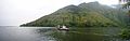
 Baie de Prony.JPG 1,614 × 868; 754 KB
-
 Chemin parc des grandes fougères.JPG 1,920 × 1,080; 993 KB
-
 Col de Prony.jpg 4,288 × 2,848; 3 MB
-
 Embouchure ouaieme.jpg 2,816 × 2,112; 2.05 MB
-
 ISS048-E-60571 - View of Earth.jpg 4,928 × 3,280; 2.45 MB
-
 ISS048-E-60572 - View of Earth.jpg 4,928 × 3,280; 2.48 MB
-
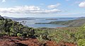
 Landscape, south of New Caledonia.jpg 1,600 × 1,044; 533 KB
-
 Montpanie.jpg 532 × 399; 65 KB
-
 New Caledonia and Vanuatu bathymetric and topographic map-fr.jpg 2,980 × 2,090; 1.53 MB
-
 P1110357pano.jpg 6,482 × 2,039; 1.2 MB
-
 Plage de Nennon.JPG 2,592 × 1,464; 883 KB
-
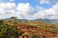
 Savane niaoulis nouvelle caledonie.jpg 1,656 × 1,242; 1.46 MB
-
 Vallée Néra.JPG 2,592 × 1,944; 2.35 MB


