Butun axtardiqlarinizi tapmaq ucun buraya: DAXIL OLUN
  Mp4 Mp3 Axtar Yukle
  Video Axtar Yukle
  Shekil Axtar Yukle
  Informasiya Melumat Axtar
  Hazir Inshalar Toplusu
  AZERI CHAT + Tanishliq
  Saglamliq Tibbi Melumat
  Whatsapp Plus Yukle(Yeni)

  • Home
  • Random
  • Nearby
  • Log in
  • Settings
Donate Now If this site has been useful to you, please give today.
  • About Wikimedia Commons
  • Disclaimers

Category:Izu Islands

English: Izu Islands, Tokyo, Japan
日本語: 伊豆諸島, 東京都
<nowiki>Islas Izu; 伊豆群島; Izu uharteak; Islles Izu; Kepulauan Izu; Izu-Inseln; Астравы Ідзу; جزایر ایزو; 伊豆群島; Izu Adaları; 伊豆諸島; Tsibirin Izu; Izuöarna; Острови Ідзу; 伊豆群島; 伊豆群岛; 이즈 제도; Izu-Eilunen; Insuloj Izu; Izu; Isole Izu; Pulou Izu; archipel d'Izu; Izu saared; Νήσοι Ίζου; Идзу; इझू बेटे; Illes Izu; Quần đảo Izu; Kepulauan Izu; איי איזו; 伊豆群島; Idzu salos; Izujski otoki; İdzu adaları; Ilhas Izu; Wyspy Izu; Izu Shotō; Izu Kûn-tó; Izuøyene; Izu-eilanden; หมู่เกาะอิซุ; Izusaaret; Իձու; دوورگەکانی ئیزو; Izu Islands; جزر إيزو; 伊豆群岛; Izuøyane; archipiélago japonés; 東京都の島嶼部; archipel japonais au nord de la mer des Philippines, Pacifique ouest; kapuloan sa Hapon; група вулканічних островів в західній частині Тихому океані; 東京都轄群島; arxipèlag japonés; saarestik Jaapanis; japanische Inselgruppe; otoška skupina na Japonskem; island group in Japan; مجموعة جزر يابانية; japonské souostroví; grupu d'islles de Xapón; Archipiélago Izu; Archipielago Izu; 豆南諸島; หมู่เกาะอิสุ; Izu eilanden; Izu-shoto; Izushotō; Izushoto; Izu; Izu-Archipel; Izu-shotō; Arcipelago Izu; مجمع الجزایر ایزو; Izušotó; 伊豆诸岛</nowiki>
Izu Islands 
island group in Japan
Mapa souostroví Izu.
 image 
 locator map image 
 detail map 
Upload media
 Wikipedia
 Wikivoyage
Instance of
  • island group
Part of
  • Tokyo Islands
  • Izu-Bonin-Mariana Arc
Named after
  • Izu Province
Located in protected area
  • Fuji-Hakone-Izu National Park
Location
  • Tokyo Prefecture
  • Tokyo
  • Japan
Located in or next to body of water
  • Pacific Ocean
Highest point
  • Mount Nishi
Population
  • 24,960 (2007)
Area
  • 301.39 km²
Elevation above sea level
  • 854 m
Map34° 20′ 00″ N, 139° 40′ 00″ E
Authority file
Wikidata Q864302
VIAF cluster ID:
Library of Congress authority ID:
NDL Authority ID:
NL CR AUT ID:
BabelNet ID:
National Library of Israel J9U ID:
  • Reasonator
  • Scholia
  • Wikidocumentaries
  • PetScan
  • statistics
  • WikiMap
  • Locator tool
  • KML file
  • WikiShootMe
  • OpenStreetMap
  • Search depicted
Edit infobox data on Wikidata

Subcategories

This category has the following 21 subcategories, out of 21 total.


  • Stacks of the Izu Islands (7 C, 1 F)

*

  • Aerial photographs of the Izu Islands (7 C)
  • Maps of the Izu Islands (18 F)
  • Minerals of Izu Islands (1 C, 1 F)
  • Tokai Kisen (3 C, 1 F)

A

  • Aogashima (2 C)
  • Aogashima, Tokyo (6 C, 30 F)

H

  • Hachijojima (15 C, 93 F)
  • Hachijōkojima (4 C, 67 F)

K

  • Kozushima (13 C, 49 F)
  • Kusaya (6 F)

M

  • Mikurajima (1 C, 21 F)
  • Miyakejima (8 C, 24 F)
  • Myojin-sho (2 C)

N

  • Niijima (8 C, 67 F)

O

  • Izu Ōshima (15 C, 129 F)

S

  • Shikinejima (8 C, 25 F)

T

  • Tadanaejima (2 F)
  • Torishima (3 C, 16 F)
  • Toshima, Tokyo (village) (1 C, 21 F)

U

  • Utoneshima (4 F)

Media in category "Izu Islands"

The following 11 files are in this category, out of 11 total.

  • Hayashima(Izu-Islands).jpg 640 × 480; 148 KB
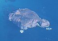
  • Jinai-island.jpg 640 × 239; 59 KB
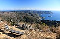
  • Minamiizu and Izu Islands from Mount Takatoori (with note).jpg 5,460 × 2,048; 2.95 MB
  • Minamiizu and Izu Islands from Mount Takatoori.jpg 5,900 × 3,840; 10.42 MB
  • Request restraint to arriving on Ogasawara Islands at new-coronavirus 02.jpg 2,448 × 3,264; 1.48 MB
  • ShikineFromKozuTyoJpDec04-1.jpg 657 × 253; 27 KB
  • 新島、式根島.jpg 5,472 × 3,648; 4.13 MB
  • 新島、早島.jpg 5,472 × 3,648; 3.94 MB
  • 自飛機上拍攝的地內島.jpg 651 × 499; 103 KB
  • 自飛機上拍攝的早島 02.jpg 1,426 × 1,008; 318 KB
  • 自飛機上拍攝的早島.jpg 5,472 × 3,648; 3.45 MB
Retrieved from "/w/index.php?title=Category:Izu_Islands&oldid=360425390"
Informasiya Melumat Axtar