Category:Korea under Japanese rule
English: Korea under colonial rule by the Empire of Japan from 1910 to 1945.
- Preceeding period: Category:Korean Empire (1897-1910)
- Subsequent period: Category:Allied-administered Korea (1945-1948).
日本語: 日本統治時代の朝鮮
한국어: 분류:일제강점기
Japanese colonial period in Chōsen (Korea), 1910–1945  .svg)  .svg) | |||||
| Upload media | |||||
| Instance of |
| ||||
|---|---|---|---|---|---|
| Part of | |||||
| Location | Empire of Japan | ||||
| Capital | |||||
| Executive body | |||||
| Anthem | |||||
| Currency | |||||
| Inception |
| ||||
| Dissolved, abolished or demolished date |
| ||||
| Population |
| ||||
| Area |
| ||||
| Religion or worldview |
| ||||
| Replaces | |||||
| Replaced by |
| ||||
 | |||||
Subcategories
This category has the following 25 subcategories, out of 25 total.
A
- Altteureu Airfield (6 F)
- Arirang (1926 film) (3 F)
B
- Baekbaekgyo (3 F)
C
- Chōsen Art Exhibition (1 F)
D
E
G
K
O
P
- Punguna (1926 film) (2 F)
R
S
- Surrender of Japan in Korea (11 F)
- Sōshi-kaimei (3 F)
Media in category "Korea under Japanese rule"
The following 200 files are in this category, out of 309 total.
(previous page) (next page)-
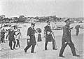
 (Japanese army at the main get of Toksu Palace, Taeanmun) (4095374967).jpg 1,536 × 1,132; 232 KB
-
 (Japanese army at the main get of Toksu Palace, Taeanmun) (4096129004).jpg 1,536 × 1,123; 245 KB
-
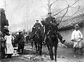 (Japanese officers on horses) (4095363713).jpg 1,458 × 1,080; 760 KB
-
 105 peoples Incident.jpg 405 × 279; 37 KB
-
 105 persons Incidents.jpg 361 × 156; 16 KB
-
 13 provinces of Korea.jpg 820 × 1,510; 187 KB
-
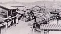
 1910년경 부산 동구 범일동 조선인시장 부산진시장.jpg 2,748 × 1,714; 3.28 MB
-
 1910년대 조선 기생.jpg 650 × 369; 129 KB
-
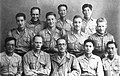
 1912 Shin Seongmo and Shin Kyusik, Shin Geonsik.jpg 480 × 666; 42 KB
-
 1915 peoples association annual convention.jpg 400 × 319; 34 KB
-
 1915년 수원농고 소풍 사진.png 761 × 561; 875 KB
-
 1916 Heungsadan's annual convention 2.jpg 1,024 × 782; 150 KB
-
 1916 Heungsadan's annual convention.jpg 450 × 314; 60 KB
-
 1920년대 남산 원경사진.jpg 10,000 × 1,052; 13.47 MB
-
 1924년 윤치호 회갑연.jpg 955 × 495; 84 KB
-
 1925 July, The Pan-Pacific Conference Honolulu in Hawai.jpg 400 × 266; 81 KB
-
 1929년 박헌영.jpg 607 × 354; 56 KB
-
 1930 무궁화 가사집.png 230 × 157; 43 KB
-
 1930s Japan Travel Poster - 12.jpg 2,121 × 3,000; 1.03 MB
-
 1930년대 대구부 거주 일본인거류민단.jpg 496 × 336; 27 KB
-
 1930년대의 속리산 말티고개.png 445 × 317; 275 KB
-
 1931년11월3일 춘천연식야구대회 시상식.jpg 1,379 × 915; 741 KB
-
 1933年6月30日「東亜日報」.jpg 725 × 789; 173 KB
-
 1936 South Korea Flood.JPG 398 × 292; 30 KB
-
 1936년 종우서관 작 무궁화 가사집과 애국가(본문의 일부).jpg 500 × 168; 23 KB
-
 1945.11.03 대한민국 임시정부 환국.jpg 500 × 360; 59 KB
-
 Administrative Map of Korea (April 1, 1914).png 2,000 × 2,835; 1.91 MB
-
 Administrative Map of Korea (August 15, 1945).png 2,000 × 2,835; 1.89 MB
-
 Anti-China riot in Heijo.JPG 404 × 319; 34 KB
-
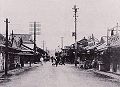
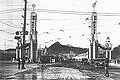
 Benten-Cho in Fuzan.JPG 548 × 301; 42 KB
-
 Border Guard Trooper and Type 11 light machine gun.jpg 1,332 × 1,020; 371 KB
-
 Byram - Petit Jap deviendra grand !, 1908 (page 105 crop).jpg 2,153 × 1,229; 1.4 MB
-
 Byram - Petit Jap deviendra grand !, 1908 (page 115 crop).jpg 2,130 × 1,239; 1.35 MB
-
 Byram - Petit Jap deviendra grand !, 1908 (page 142 crop).jpg 1,217 × 851; 611 KB
-
 Byram - Petit Jap deviendra grand !, 1908 (page 162 crop).jpg 1,199 × 853; 661 KB
-
 Byram - Petit Jap deviendra grand !, 1908 (page 163 crop).jpg 1,199 × 920; 587 KB
-
 Byram - Petit Jap deviendra grand !, 1908 (page 172 crop).jpg 1,212 × 908; 707 KB
-
 Byram - Petit Jap deviendra grand !, 1908 (page 173 crop).jpg 1,199 × 770; 444 KB
-
 Byram - Petit Jap deviendra grand !, 1908 (page 183 crop).jpg 1,192 × 1,091; 618 KB
-
 Byram - Petit Jap deviendra grand !, 1908 (page 185 crop).jpg 1,204 × 823; 537 KB
-
 Byram - Petit Jap deviendra grand !, 1908 (page 191 crop).jpg 1,225 × 861; 459 KB
-
 Chemical factory in Kankou.JPG 536 × 286; 41 KB
-
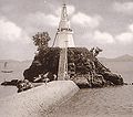 Chinnampo Lighthouse.JPG 377 × 332; 25 KB
-
 Chosen Mapp (1920).jpeg 908 × 1,303; 231 KB
-
 Chosen Savings Bank advertisement.jpg 445 × 705; 141 KB
-
 Chosun Ilbo 1926-05-31.png 1,492 × 2,949; 156 KB
-
 ChosunIlbo (January1-1940).jpg 3,582 × 4,876; 9.9 MB
-
 Chūsei-hoku Prefecture (August 15, 1945).png 2,000 × 2,835; 590 KB
-
 Chūsei-nan Prefecture (August 15, 1945).png 2,000 × 2,835; 595 KB
-
 COMFORT Ad.gif 288 × 249; 31 KB
-
 Control point surveying.jpg 1,080 × 718; 214 KB
-
 Daejeon 1940s Map.jpg 3,695 × 2,601; 2.76 MB
-
 Dansungsa c1920.jpg 1,420 × 1,188; 1.21 MB
-
 Dong-a Ilbo 19240528.png 371 × 301; 132 KB
-
 Dong-hwe Rhee's Letter.jpg 240 × 330; 30 KB
-
 Eagle Project - First Korean and American alliance.jpg 580 × 367; 52 KB
-
 Earthenware Shop around 1910s, Photo-No.5070.jpg 490 × 640; 232 KB
-
 Eisenbahnen in Korea.jpg 1,205 × 1,963; 367 KB
-
 Emblem of Busan-bu.svg 1,063 × 1,063; 4 KB
-
 Emblem of Cheongjin-bu.svg 1,067 × 1,063; 5 KB
-
 Emblem of Daegu-bu.svg 1,058 × 1,064; 5 KB
-
 Emblem of Daejeon-bu.svg 960 × 1,042; 5 KB
-
 Emblem of Gunsan-bu.svg 1,061 × 1,061; 5 KB
-
 Emblem of Gwangju-bu.svg 1,058 × 1,061; 5 KB
-
 Emblem of Gyeongseong-bu.svg 1,036 × 1,056; 5 KB
-
 Emblem of Hamheung-bu.svg 942 × 1,068; 4 KB
-
 Emblem of Incheon-bu.svg 1,113 × 1,068; 16 KB
-
 Emblem of Jinnampo-bu.svg 1,065 × 1,063; 5 KB
-
 Emblem of Kaesung-bu.svg 1,029 × 1,056; 11 KB
-
 Emblem of Masan-bu.svg 1,056 × 1,056; 4 KB
-
 Emblem of Mukpo-bu.svg 967 × 1,073; 4 KB
-
 Emblem of Pyeongyang-bu.svg 1,075 × 1,073; 5 KB
-
 Emblem of Sinuiju-bu.svg 1,063 × 1,063; 4 KB
-
 Emblem of Wonsan-bu.svg 1,049 × 1,084; 3 KB
-
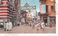 First Street of Honmachi Keijo Korea 1930s.png 1,200 × 754; 1.79 MB
-
 Frame house along Seikei-Sen.JPG 569 × 378; 72 KB
-
 Fukuyama-Cho in Mokuho.JPG 480 × 347; 30 KB
-
 Fusan map circa 1930.PNG 1,109 × 1,056; 861 KB
-
 Fusan-Matsushima Beach circa 1930.JPG 521 × 364; 68 KB
-
 Gendarmes in Korea under Japanese rule.JPG 530 × 226; 40 KB
-
 Go M.j and Ju S.j and Heo J.s.jpg 350 × 210; 18 KB
-
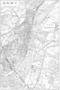
 Hanmonten map circa 1938.PNG 1,194 × 712; 675 KB
-
 Heian-hoku Prefecture (August 15, 1945).png 2,000 × 2,835; 617 KB
-
 Heian-Hoku Provincial Police.JPG 410 × 249; 28 KB
-
 Heian-nan Prefecture (August 15, 1945).png 2,000 × 2,835; 603 KB
-
 Heijo map circa 1930.PNG 1,097 × 1,646; 1.23 MB
-
 Heijo map in 1934.jpg 2,990 × 2,227; 1.64 MB
-
 Honcho in Gishu.JPG 530 × 297; 42 KB
-
 Honcho in Kankou.JPG 406 × 267; 23 KB
-
 Honcho in Koshu.JPG 516 × 329; 31 KB
-
 Hungnam korea.jpg 2,036 × 804; 252 KB
-
 Hyochangwon as Korea's first golf course - Original.png 2,404 × 1,779; 6.6 MB
-
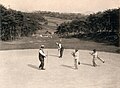 Hyochangwon as Korea's first golf course.jpg 2,334 × 1,714; 3.32 MB
-
 Hyochangwon as Korea's first golf course.png 2,334 × 1,714; 7.01 MB
-
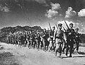 IJA Special Volunteers by Korean people.JPG 834 × 636; 239 KB
-
 Ikoma-Cho in Ranan.JPG 546 × 316; 31 KB
-
 Imperial Army Special volunteer 1.jpg 1,648 × 1,168; 873 KB
-
 Imperial Army Special volunteer 2.jpg 1,648 × 1,168; 589 KB
-
 Industrialization of Korea under Japanese rule.svg 659 × 390; 25 KB
-
 Japanese Korea (orthographic projection).svg 600 × 600; 515 KB
-
 Japanese Regulations Pg1.jpg 1,749 × 2,949; 1,015 KB
-
 Japanese Regulations Pg2.jpg 1,734 × 3,010; 966 KB
-
 Japanese Regulations Pg3.jpg 1,709 × 2,933; 556 KB
-
 Japanese Regulations Pg4.jpg 1,764 × 2,958; 662 KB
-
 Japanese Regulations Pg5.jpg 1,775 × 2,923; 651 KB
-
 Jeong HK and Seo JP and Syngman Rhee in Philadelphia 1919.jpg 450 × 294; 89 KB
-
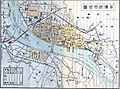
 Jinsen map circa 1930.PNG 1,104 × 840; 682 KB
-
 Kaijo map circa 1930.PNG 1,138 × 837; 727 KB
-
 Kanggeonneo maeul 1935.jpg 1,309 × 777; 210 KB
-
 Kankyō-hoku Prefecture (August 15, 1945).png 2,000 × 2,835; 602 KB
-
 Kankyō-nan Prefecture (August 15, 1945).png 2,000 × 2,835; 617 KB
-
 Kasuga-Cho in Taiden.JPG 534 × 295; 39 KB
-
 Keijō Army tVolunteer Training Center No.1.jpg 872 × 583; 172 KB
-
 Keijō Army tVolunteer Training Center No.2.jpg 697 × 363; 68 KB
-
 Keiki Prefecture (August 15, 1945).png 2,000 × 2,835; 607 KB
-
 Keishō-hoku Prefecture (August 15, 1945).png 2,000 × 2,835; 614 KB
-
 Keishō-nan Prefecture (August 15, 1945).png 2,000 × 2,835; 603 KB
-
 Kenjiho Iron works of Mitsubishi.JPG 510 × 270; 36 KB
-
 Kim Seongsu and Chang Deoksu.jpg 240 × 329; 24 KB
-
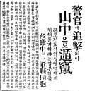 Kinomoto Incident Article (January 7, 1926).jpg 938 × 1,012; 227 KB
-
 Kisaeng training.JPG 322 × 454; 25 KB
-
 Kongosandentetsu 1940 tt.jpg 651 × 195; 65 KB
-
 Kongosandentetsu logo.png 461 × 458; 8 KB
-
 Kongosandentetsu old map.jpg 1,701 × 387; 235 KB
-
 Korea Exhibition 1929.JPG 444 × 296; 37 KB
-
 Korea map 1939-es.svg 634 × 387; 1.31 MB
-
 Korea map 1939-hu.svg 634 × 387; 2.2 MB
-
 Korea map 1939.svg 634 × 387; 2.26 MB
-
 Korea map in 1930s.PNG 1,147 × 1,753; 972 KB
-
 KOREA REVIEW.jpg 400 × 551; 120 KB
-
 Flag map of colonial Korea.jpg 228 × 444; 88 KB
-
 Korean children holding comfort bags.jpg 700 × 516; 94 KB
-
 Korean children holding comfort bags.png 415 × 306; 224 KB
-
 Korean governors of provinces of colonial Korea.jpg 820 × 1,823; 366 KB
-
 Korean independence league 3.jpg 640 × 418; 53 KB
-
 Korean provinces with colonial names ru.jpg 820 × 2,200; 238 KB
-
 Korean women packing comfort bags.jpg 1,000 × 642; 148 KB
-
 Koreans displaced during World War II return to Busan, Korea, from Japan (cropped).jpg 2,824 × 2,315; 1.25 MB
-
 Koreans displaced during World War II return to Busan, Korea, from Japan.jpg 3,600 × 2,400; 1.34 MB
-
 Koreans in osaka.jpg 2,417 × 1,826; 2.07 MB
-
 KSH Jeongdong (100).JPG 2,304 × 3,072; 3.36 MB
-
 Kyeonghakwon.jpg 446 × 316; 54 KB
-
 Kyujo-Yohai by Korean people.JPG 524 × 362; 34 KB
-
 Kōgen Prefecture (August 15, 1945).png 2,000 × 2,835; 620 KB
-
 Kōkai Prefecture (August 15, 1945).png 2,000 × 2,835; 607 KB
-
 Lee Beom-seok and Chang Jun-ha 1945-August-16.jpg 2,976 × 1,505; 2.13 MB
-
 L’Indépendance de la Corée et la Paix-01.jpg 2,877 × 1,785; 1.04 MB
-
 L’Indépendance de la Corée et la Paix-02.jpg 2,160 × 1,514; 775 KB
-
 L’Indépendance de la Corée et la Paix-03.jpg 2,181 × 1,524; 723 KB
-
 L’Indépendance de la Corée et la Paix-04.jpg 2,160 × 1,516; 756 KB
-
 L’Indépendance de la Corée et la Paix-05.jpg 1,690 × 1,194; 438 KB
-
 L’Indépendance de la Corée et la Paix-06.jpg 1,200 × 824; 229 KB
-
 L’Indépendance de la Corée et la Paix-07.jpg 1,210 × 872; 207 KB
-
 L’Indépendance de la Corée et la Paix-08.jpg 1,208 × 828; 254 KB
-
 L’Indépendance de la Corée et la Paix-09.jpg 1,304 × 888; 247 KB
-
 L’Indépendance de la Corée et la Paix-10.jpg 1,288 × 888; 237 KB
-
 L’Indépendance de la Corée et la Paix-carte-1.jpg 2,036 × 3,888; 564 KB
-
 MaeilShimpo (August14-1945).jpg 640 × 469; 95 KB
-
 Manchuria and Korea travel advertisement in 1930s.jpg 626 × 904; 150 KB
-
 Map of Chosen.jpg 2,055 × 3,163; 2.19 MB
-
 Map of Pyongyang - 1946 - Glossary.jpg 240 × 400; 108 KB
-
 Map of Pyongyang - 1946 - Yanggak Bridge.png 1,072 × 848; 1.95 MB
-
 Martial law, Korea 1900s.jpg 2,110 × 1,431; 435 KB
-
 Mausoleum of Jizi1.JPG 542 × 308; 48 KB
-
 Mausoleum of Jizi2.JPG 444 × 240; 39 KB
-
 Miya-Cho in Jinsen.JPG 362 × 222; 22 KB
-
 MNSP1939y10m18d.jpg 500 × 340; 26 KB
-
 Na H.S and Kim W.Y was 1926 in Korea.jpg 158 × 220; 19 KB
-
 Na Hye-sok's familys.jpg 500 × 316; 42 KB
-
 Naka-Cho in Gensan.JPG 486 × 298; 37 KB
-
 Nanum-Girlsculpture.JPG 1,024 × 576; 333 KB
-
 National Geographic map of Korea and Japan, 1945.jpg 5,339 × 3,795; 6.58 MB
-
 Omaki no Chaya.JPG 398 × 284; 33 KB
-
 One of the Dokliphyuphoe.jpg 220 × 165; 21 KB
-
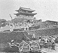
 Pagoda Park in 1930s.JPG 262 × 452; 20 KB
-
 Panax ginseng advertisement in 1930s.jpg 625 × 885; 241 KB
-
 Park Joong-yang.jpg 300 × 489; 59 KB
-
 Philip Jaisohn's Graduation from Columbia Medical College 1892.jpg 450 × 286; 84 KB
-
 Population Density Map of Korea (December 31, 1944).png 2,000 × 2,835; 2.04 MB
-
 Population of Korea under Japanese rule-de.svg 619 × 340; 64 KB
-
 Population of Korea under Japanese rule-en.svg 619 × 340; 61 KB
-
 Population of Korea under Japanese rule-fr.svg 619 × 340; 60 KB
-
 Population of Korea under Japanese rule-ko.svg 619 × 340; 64 KB
-
 Port of Jinsen.JPG 436 × 242; 21 KB
-
 Port of Seishin.JPG 505 × 310; 44 KB
-
 Postcard of Docho-Dori Street in Sinuiju (1930s).jpg 1,280 × 821; 301 KB
-
 Procession in celebration of Fall of Singapore by Keijo citizen.JPG 442 × 337; 40 KB
-
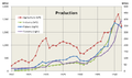 Production in Korea under Japanese rule.png 671 × 396; 34 KB
-
 Public regular school enrollment rate.svg 926 × 511; 36 KB
-
 Pyongyangarmymapservice1946 Runga Bridge.png 668 × 497; 617 KB
-
 Railway in Korea under Japanese rule.svg 618 × 363; 45 KB
-
 Ranan map circa 1930.PNG 1,093 × 805; 636 KB
-
 Red-colored torii-shaped gate around 1910s, Photo-No.5016.jpg 483 × 640; 219 KB
-
 Sakae-Cho in Gunsan.JPG 418 × 241; 22 KB
-
 Seidaimon Prison1.JPG 442 × 192; 26 KB
-
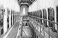 Seidaimon Prison2.JPG 404 × 265; 32 KB
-
 Seishin 1930s.png 1,080 × 693; 1.47 MB
-
 Seoul Station in 1945.8.15.jpg 1,504 × 2,144; 1.09 MB
-
 Severance Hospital circa 1930.JPG 556 × 373; 63 KB
-
 Shakuoji.png 1,085 × 692; 1.49 MB
_(4095374967).jpg)
_(4096129004).jpg)
_(4095363713).jpg)


.png)
.png)


.jpg)
.jpg)
.jpg)
.jpg)
.jpg)
.jpg)
.jpg)
.jpg)
.jpg)
.jpg)


.jpeg)


.jpg)
.png)
.png)


.png)

.png)


.svg)


.png)
.png)


.png)
.png)
.png)


.jpg)


.jpg)


.JPG)


.png)
.png)


.png)


.jpg)


.jpg)
.jpg)