Butun axtardiqlarinizi tapmaq ucun buraya: DAXIL OLUN
  Mp4 Mp3 Axtar Yukle
  Video Axtar Yukle
  Shekil Axtar Yukle
  Informasiya Melumat Axtar
  Hazir Inshalar Toplusu
  AZERI CHAT + Tanishliq
  Saglamliq Tibbi Melumat
  Whatsapp Plus Yukle(Yeni)

  • Home
  • Random
  • Nearby
  • Log in
  • Settings
Donate Now If this site has been useful to you, please give today.
  • About Wikimedia Commons
  • Disclaimers

Category:Lop Nur

English: Lop Nur
中文(简体):​罗布泊
Object location40° 05′ 00″ N, 90° 05′ 00″ E Kartographer map based on OpenStreetMap.View all coordinates using: OpenStreetMapCopy geo coordinates to Wikidatainfo 40.083333; 90.083333
There is a discrepancy of 43510 meters between the above coordinates and the ones stored at Wikidata (40°10′0″N 90°35′0″E, precision: 1850 m). Please reconcile them.
<nowiki>Lop Nor; Лобнор; لوبنور; Лоп нур; Lacul Lop Nor; لوپ نور; Lobnor; Лобнор; 羅布泊; 罗布泊; Lobnor; Лобнор; Lop Nor; Lobnor; লোপ নুর; Lob Nor; Lop Nur; لوبنور; Lobnor; Лоп Нур; 罗布泊; Лобнор; Lop Nur; Lop Nor; Lobnor gölü; Lop Nur; بحيرة لوب نور; Lobnor; Lop Nor; Lob Nor; Lop Nor; Լոբնոր; 罗布泊; ლობნორი; ロプノール; לופ נור; Lob Nor; लोप नुर; లోప్ నూర్; ਲੋਪ ਨੁਰ ਝੀਲ; Lopnur; Lop Nur; Lop Nur; Lop Nor; Lop Nor; Лобнор көлү; Lob Nuur; Lopnūrs; Lobnoras; Lop Nor; Лоб нуур; Лобнор; لوپنۇر; Lop Nur; Lob-nor; 로프노르; 羅布泊; لوپ نور; 羅布泊; Lop Nur; Lop Nor; 罗布泊; Lop-nór; 罗布泊; Lop Nur; grupo de pequeños lagos; চীনের জিনজিয়াংয়ের বেইঙ্গোলিন প্রিফেকচারের সাবেক লবণাক্ত হ্রদ; tó Kínában, Hszincsiang–Ujgur Autonóm Területen; lac chinois; uttorkad saltsjö i Kina; 中央アジア・タリム盆地のタクラマカン砂漠北東部に、かつて存在した内陸湖。跡地は、現在の中華人民共和国新疆ウイグル自治区バインゴリン・モンゴル自治州チャルクリク県に属する; אגם ברפובליקה העממית של סין; meer in Volksrepubliek China; бывшее озеро в СУАР, КНР; former salt lake in Bayingolin Prefecture, Xinjiang, China; ehemaliger Salzsee in Westchina; 중앙 아시아 • 타림 분지의 타클라마칸 사막 북동부에 이전에 존재했던 내륙 호수; liqen; بحيرة في الصين; 新疆湖泊; salah satu danau di dunia; Lop Nor; লোপনুর; Lop Nor; Лоп-Нор; Lop Nur; Luobubo; Lop Nor; Taitema Lake; Lobnūrs; Lop Nor; Loba ezers; Lobnors; Lobnora ezers; Lop Nuur; Lop Nur; 牢兰海; 辅日海; 羅布泊; 盐泽城; 罗布淖尔; 盐泽; 蒲昌海; Lop Nuras; Lop Nur; ロプノル; ロプ・ノール湖; ロプ・ノール; 羅布泊; ロプノル湖; ロブノール; ロプ湖; ロプノール湖; אגם לופ; Lop Nur; Lo-pu po; Lo pu po; Lop-nor; Lop Nur; Loopnor; Łob-nor; Lop Nur; Lop Nur; Lop Nor; Lob Nur; Tchan-tchan; Lop Nur; Txan-txan; Lop Nor; 罗布淖尔; Lob-Nor; Lop Nur; Jezero Lop; Qoraqoʻshun; Qoraqo‘shun; Qoraqo`shun; Qoraqo'shun; Lob Nor; Lob Nur; Lob-nor; Lob-nur; Lo-pu-po; Luobubo; Lake Luobu; Lake Lo-pu; Lobnor; Lopnur; Lobnur; Lopnor; Lob Nuur; Lop Nur; Lopnor; Lob-nor; Lop nor; Lobnur; ᠯᠣᠪ ᠨᠠᠭᠤᠷ</nowiki>
Lop Nur 
former salt lake in Bayingolin Prefecture, Xinjiang, China
Upload media
 Wikipedia
Instance of
  • salt lake
LocationRuoqiang County, Bayingolin Mongol Autonomous Prefecture, Xinjiang, PRC
Length
  • 85 km
Area
  • 2,375 km²
Elevation above sea level
  • 780 m
Inflows
  • Tarim River
  • Shule River
Different from
  • Yuli County
Map40° 10′ 00″ N, 90° 35′ 00″ E
Authority file
Wikidata Q319412
VIAF cluster ID:
  • Reasonator
  • Scholia
  • Wikidocumentaries
  • PetScan
  • statistics
  • WikiMap
  • Locator tool
  • KML file
  • WikiShootMe
  • OpenStreetMap
  • Search depicted
Edit infobox data on Wikidata

Subcategories

This category has the following 6 subcategories, out of 6 total.

5

  • 596 (nuclear test) (12 F)

B

  • Christoph Baumer (3 F)

D

  • Dunhuang Yardang National Geopark (1 C, 24 F)

L

  • Loulan (2 C, 1 P, 24 F)

S

  • Satellite pictures of Lop Nur (76 F)

T

  • Test No. 6 (6 F)

Pages in category "Lop Nur"

This category contains only the following page.

L

  • Lop Nur

Media in category "Lop Nur"

The following 31 files are in this category, out of 31 total.

  • 1883 map of Russia in Asia, Turkestan &c.jpg 6,062 × 6,768; 6.84 MB
  • STANFORD(1917) p61 PLATE19. SINKIANG (14597194848).jpg 3,712 × 2,302; 1.51 MB
  • The Ruins of Lou-lan.jpg 1,392 × 1,031; 127 KB
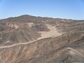
  • 20240324 Deserts near Lop Nur 01.jpg 1,800 × 1,200; 1.52 MB
  • 20240324 Deserts near Lop Nur 02.jpg 1,800 × 1,200; 1.69 MB
  • 88 of 'The Earth and its Inhabitants. The European section of the Universal Geography by E. Reclus. Edited by E. G. Ravenstein. Illustrated by ... engravings and maps' (11271322034).jpg 1,686 × 1,068; 369 KB
  • Drill Tower for Geological Exploration - panoramio.jpg 2,592 × 1,944; 1.03 MB
  • EuropoidMaskLopNurChina2000-1000BCE.jpg 567 × 827; 133 KB
  • From Kulja, across the Tian Shan to Lob-Nor - Map showing comparisons between Chinese and Prejevalsky's Geography.jpg 2,886 × 2,256; 598 KB
  • Lop Nor - panoramio (1).jpg 2,592 × 1,944; 1.07 MB
  • Lop Nor - panoramio.jpg 2,592 × 1,944; 1.08 MB
  • Lop nor 2007 800.jpg 800 × 535; 104 KB
  • Lop Nor.jpg 2,592 × 1,944; 1.1 MB
  • Lop Nur Runway, Xinjiang, China (31108f6c-701e-4483-8200-3cd18a2ab1e3).tiff 13,438 × 13,440, 6 pages; 248.77 MB
  • Lop Nur Runway, Xinjiang, China (950b9421-5fdb-4a1c-9969-2598de859d8a).tiff 6,450 × 6,451, 5 pages; 59.75 MB
  • Map of eastern Xinjiang 1939 with prehistoric sites and the courses of the Silk Roads.jpg 831 × 777; 297 KB
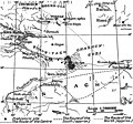
  • Map of the Lop Nor region by Folke Bergman 1935.jpg 1,002 × 683; 310 KB
  • On A Small Hill - panoramio.jpg 2,592 × 1,944; 1.09 MB
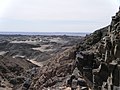
  • Rock Weathering - panoramio.jpg 2,592 × 1,944; 1.13 MB
  • Ruins of desert Cathay - personal narrative of explorations in Central Asia and westernmost China (1912) (14596472350).jpg 2,264 × 1,676; 511 KB
  • Ruins of desert Cathay - personal narrative of explorations in Central Asia and westernmost China (1912) (14596482020).jpg 2,112 × 1,644; 416 KB
  • Ruins of desert Cathay - personal narrative of explorations in Central Asia and westernmost China (1912) (14596483210).jpg 2,268 × 1,648; 355 KB
  • Ruins of desert Cathay - personal narrative of explorations in Central Asia and westernmost China (1912) (14596515429).jpg 2,272 × 3,216; 1.1 MB
  • Ruins of desert Cathay - personal narrative of explorations in Central Asia and westernmost China (1912) (14596520499).jpg 2,268 × 2,960; 887 KB
  • Ruins of desert Cathay - personal narrative of explorations in Central Asia and westernmost China (1912) (14596521729).jpg 2,272 × 1,652; 502 KB
  • Ruins of desert Cathay - personal narrative of explorations in Central Asia and westernmost China (1912) (14596673767).jpg 2,276 × 1,664; 496 KB
  • Ruins of desert Cathay - personal narrative of explorations in Central Asia and westernmost China (1912) (14782838512).jpg 2,264 × 1,664; 420 KB
  • Ruins of desert Cathay - personal narrative of explorations in Central Asia and westernmost China (1912) (14803040213).jpg 2,280 × 1,616; 503 KB
  • Shulerivermap.jpg 827 × 496; 288 KB
  • О.Telehan'.М.М.Przheval'sky.1953.Illustration.Lop.Nur.Lake.jpg 295 × 208; 54 KB
  • 罗布泊人村寨.jpg 3,264 × 2,448; 1.62 MB
Retrieved from "/w/index.php?title=Category:Lop_Nur&oldid=1020487039"
Informasiya Melumat Axtar