Category:Musselburgh
town in East Lothian, Scotland, UK  Pont John Rennie dros Afon Esk ym Musselburgh | |||||
| Upload media | |||||
| Instance of |
| ||||
|---|---|---|---|---|---|
| Location |
| ||||
| Located in or next to body of water | |||||
| Population |
| ||||
| Area |
| ||||
 | |||||
English: Musselburgh is a town in East Lothian, Scotland.
Subcategories
This category has the following 18 subcategories, out of 18 total.
A
B
- Battle of Pinkie Cleugh (9 F)
C
E
F
L
N
- Newhailes Shell Grotto (6 F)
- Night in Musselburgh (3 F)
P
Q
R
S
T
Media in category "Musselburgh"
The following 98 files are in this category, out of 98 total.
-
 48 Bus Musselburgh.jpg 3,000 × 4,000; 4.28 MB
-
 A Bass Rock a háttérben (Bass Rock in the background) - panoramio.jpg 1,600 × 1,200; 736 KB
-
 Air Training Corps ^ Army Cadet Force Huts, Musselburgh - geograph.org.uk - 3726343.jpg 5,184 × 3,456; 6.46 MB
-
 Back wall of the Newhailes Shell Grotto, interior, Musselburgh, East Lothian.jpg 4,608 × 3,456; 5.21 MB
-
 Bee collecting thistle pollen June 2024.jpg 1,080 × 1,905; 378 KB
-
 Big brother is on the case - geograph.org.uk - 1195834.jpg 640 × 480; 94 KB
-
 Big Ox - geograph.org.uk - 963556.jpg 640 × 359; 68 KB
-
 Blue butterfly June 2024.jpg 1,080 × 1,905; 465 KB
-
 Brunton's Wireworks - geograph.org.uk - 932842.jpg 640 × 480; 53 KB
-
 Brunton's Wireworks site - geograph.org.uk - 1776903.jpg 640 × 359; 57 KB
-
 Buff tailed bumble bee on Artichoke flower - Flickr - kitmasterbloke.jpg 1,153 × 805; 176 KB
-
 Bug hunting June 2024.jpg 1,080 × 1,905; 601 KB
-

-
 Carrion Crow (Corvus corone), Musselburgh - geograph.org.uk - 5636183.jpg 1,024 × 683; 140 KB
-
 Common Gull (Larus canus), Musselburgh - geograph.org.uk - 5636180.jpg 1,024 × 684; 65 KB
-
 Construction of a supermarket - geograph.org.uk - 1776898.jpg 640 × 359; 71 KB
-
 Curlew (Numenius arquata), Musselburgh - geograph.org.uk - 7460643.jpg 1,600 × 1,068; 560 KB
-
 Cycleway to Musselburgh - geograph.org.uk - 1204394.jpg 640 × 480; 97 KB
-
 Dead Goldeneye (Bucephala clangula), Musselburgh - geograph.org.uk - 5636169.jpg 1,024 × 683; 167 KB
-
 E&M horseburgh -MH08 EMH (8528757794).jpg 2,592 × 1,728; 744 KB
-
 Eider ducks, River Esk estuary - geograph.org.uk - 7611060.jpg 1,600 × 964; 294 KB
-
 Eskmouth - geograph.org.uk - 5608587.jpg 1,024 × 576; 214 KB
-
 Field of Rape, Crookston - geograph.org.uk - 166123.jpg 640 × 463; 132 KB
-
 First East Lothian tour musselburgh (8521533837).jpg 2,592 × 1,728; 1.04 MB
-
 Fisherrow Harbour entrance, Musselburgh.jpg 4,608 × 3,456; 3.58 MB
-
 Fisherrow Harbour, Musselburgh - view south.jpg 4,608 × 3,456; 3.61 MB
-
 Fisherrow Harbour, Musselburgh - view west.jpg 4,608 × 3,456; 3.59 MB
-
 Fisherrow Sands - detail - geograph.org.uk - 2394093.jpg 2,592 × 1,944; 3.47 MB
-
 Flats on Inveresk Road, Musselburgh - geograph.org.uk - 4243031.jpg 1,600 × 1,070; 713 KB
-
 Gulls at the mouth of the River Esk, Musselburgh - geograph.org.uk - 5636164.jpg 1,024 × 683; 160 KB
-
 Horsey golf sculpture at Musselburgh - geograph.org.uk - 1744315.jpg 1,024 × 768; 108 KB
-

-
 Joppa from over the Firth of Forth - geograph.org.uk - 3930885.jpg 3,264 × 2,448; 3.84 MB
-
 Ladies' Walk bridge site, Newhailes, Musselburgh.jpg 3,850 × 3,220; 5.8 MB
-
 Ladies' Walk ha-ha site, Newhailes, Musselburgh.jpg 4,608 × 3,454; 6.37 MB
-
 Looking back to Musselburgh from Fisherrow Sands - geograph.org.uk - 2394077.jpg 2,592 × 1,944; 2.72 MB
-
 Looking in through the office window - geograph.org.uk - 932845.jpg 480 × 640; 117 KB
-
 Loretto Junior School - geograph.org.uk - 1195845.jpg 640 × 480; 92 KB
-
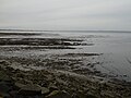
 Low tide at Musselburgh - geograph.org.uk - 2394053.jpg 2,592 × 1,944; 3.3 MB
-

-
-
 Map of Edinburghshire Sheet 003, Ordnance Survey (NLS), Published 1854.jpg 16,536 × 11,496; 25.81 MB
-
 Map of Edinburghshire Sheets 2 3 6 7, Edinburgh and Surrounding Region (Composite), 1854-1855.jpg 30,023 × 20,073; 60.4 MB
-
 Mercat Cross, High Street, Musselburgh - geograph.org.uk - 3726770.jpg 3,456 × 5,184; 6.83 MB
-
 Mouth of the River Esk - geograph.org.uk - 6367789.jpg 1,600 × 1,067; 318 KB
-
 Mouth of the River Esk, Musselburgh - geograph.org.uk - 3393609.jpg 600 × 450; 56 KB
-
 Mussel Monument by Musselburgh Beach in Scotland.jpg 3,024 × 4,032; 3.59 MB
-
 Musselbrugh.png 1,084 × 700; 35 KB
-
 Musselburgh beach - geograph.org.uk - 7130723.jpg 4,000 × 3,000; 2.54 MB
-
 Musselburgh Cross - geograph.org.uk - 2882320.jpg 433 × 640; 70 KB
-
 Musselburgh from the air (geograph 2208866).jpg 2,592 × 1,944; 1.38 MB
-
 Musselburgh from the air (geograph 3467176).jpg 640 × 480; 169 KB
-
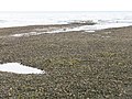
 Musselburgh Sands - geograph.org.uk - 49307.jpg 640 × 480; 48 KB
-
 Musselburgh Sands - geograph.org.uk - 5065789.jpg 800 × 600; 177 KB
-
 Musselburgh.png 695 × 480; 551 KB
-
 Mussleburgh banner Fisherrow Harbour.JPG 2,100 × 300; 484 KB
-
 Ordnance Survey Sheet NT 27 37 Edinburgh, Published 1969.jpg 14,854 × 7,093; 37.01 MB
-
 Ordnance Survey Sheet NT 37 Musselburgh, Published 1955.jpg 7,596 × 8,771; 15.13 MB
-
 Outfall pipelines, Musselburgh ash lagoons - geograph.org.uk - 6550833.jpg 1,024 × 768; 149 KB
-
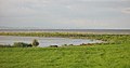 Oystercatcher roost, Musselburgh - geograph.org.uk - 955780.jpg 640 × 334; 55 KB
-
 Oystercatchers on the edge - geograph.org.uk - 2394056.jpg 2,592 × 1,944; 3.08 MB
-
 Oystercatchers on the move - geograph.org.uk - 2394068.jpg 2,592 × 1,944; 1.35 MB
-
 Pinkie Braes - geograph.org.uk - 326463.jpg 640 × 482; 67 KB
-
-
 Purple flower June 2024.jpg 1,080 × 1,905; 439 KB
-
 Sea Wall - geograph.org.uk - 3503324.jpg 640 × 421; 361 KB
-
 Seawall at Musselburgh - geograph.org.uk - 5636165.jpg 1,024 × 683; 135 KB
-
 Seawall, Musselburgh ash lagoons - geograph.org.uk - 5065795.jpg 800 × 600; 173 KB
-
 Skate park, Pinkie Braes - geograph.org.uk - 326481.jpg 640 × 480; 56 KB
-

-
 Sunrise over Musselburgh (6182777106).jpg 4,928 × 3,264; 1.33 MB
-

-
 The mouth of the River Esk - geograph.org.uk - 2394063.jpg 2,592 × 1,944; 1.63 MB
-
 This way to the target - geograph.org.uk - 1064269.jpg 640 × 480; 102 KB
-
 View towards Leith - geograph.org.uk - 5608589.jpg 1,024 × 576; 282 KB
-
 Volunteer Arms - Staggs - geograph.org.uk - 959484.jpg 640 × 359; 67 KB
-
 Waterfall feature, Newhailes, Musselburgh.jpg 4,606 × 3,454; 6.22 MB
-
 Where have all the trolleys gone^ - geograph.org.uk - 2394110.jpg 2,592 × 1,944; 3.34 MB
-
 White lining - geograph.org.uk - 220693.jpg 640 × 498; 54 KB
-
 Bedrock - geograph.org.uk - 412890.jpg 480 × 640; 136 KB
-

-

-
 Crookston - geograph.org.uk - 19717.jpg 640 × 480; 98 KB
-
 Deep excavations, Prestonpans - geograph.org.uk - 412879.jpg 490 × 640; 101 KB
-
 Di Rollo - geograph.org.uk - 220694.jpg 640 × 480; 96 KB
-
 Fa'side Inn - geograph.org.uk - 712568.jpg 640 × 340; 39 KB
-
 Field near River Esk - geograph.org.uk - 223491.jpg 640 × 452; 62 KB
-
 Former paper works. - geograph.org.uk - 111887.jpg 640 × 457; 50 KB
-
 Gulls, Musselburgh Sands. - geograph.org.uk - 49308.jpg 640 × 436; 39 KB
-
 Himalayan Balsam - geograph.org.uk - 28580.jpg 640 × 480; 127 KB
-
 Home Farm - geograph.org.uk - 19714.jpg 640 × 480; 74 KB
-
 Last of the barley. - geograph.org.uk - 33871.jpg 640 × 480; 78 KB
-
 Luca's - geograph.org.uk - 60963.jpg 640 × 480; 68 KB
-
 Musselburgh - geograph.org.uk - 663115.jpg 640 × 480; 58 KB
-
 Musselburgh Sands - geograph.org.uk - 49309.jpg 640 × 480; 53 KB
-
 Phillips and Sons - geograph.org.uk - 412843.jpg 640 × 480; 49 KB
-
 Phillips and Sons - geograph.org.uk - 412846.jpg 640 × 480; 33 KB
-
 Refurbishing housing stock - geograph.org.uk - 33879.jpg 614 × 478; 75 KB

_-_panoramio.jpg)


,_Musselburgh_-_geograph.org.uk_-_5636183.jpg)
,_Musselburgh_-_geograph.org.uk_-_5636180.jpg)

,_Musselburgh_-_geograph.org.uk_-_7460643.jpg)

,_Musselburgh_-_geograph.org.uk_-_5636169.jpg)
.jpg)


.jpg)


,_Published_1854.jpg)
,_1854-1855.jpg)


.jpg)
.jpg)


.jpg)


