Category:Naruto Strait
strait    | |||||
| Upload media | |||||
| Instance of | |||||
|---|---|---|---|---|---|
| Located in protected area | |||||
| Location | |||||
| Has part(s) | |||||
| Heritage designation | |||||
| Width |
| ||||
| Different from | |||||
 | |||||
Subcategories
This category has the following 6 subcategories, out of 6 total.
O
S
T
U
W
Media in category "Naruto Strait"
The following 42 files are in this category, out of 42 total.
-
 2016-11-12 2016-11-12 Naruto Strait 鳴門海峡 DSCF3847.jpg 2,304 × 1,536; 869 KB
-
 2016-11-12 Kobe-Awaji-Naruto Expressway 神戸淡路鳴門自動車道 DSCF3857.jpg 2,304 × 1,536; 836 KB
-
 2016-11-12 Kobe-Awaji-Naruto Expressway 神戸淡路鳴門自動車道 DSCF3864.jpg 2,304 × 1,536; 816 KB
-
 2016-11-12 Naruto Strait 鳴門海峡 DSCF3833.jpg 2,304 × 1,536; 839 KB
-
 2016-11-12 Naruto Strait 鳴門海峡 DSCF3855☆彡.jpg 2,304 × 1,536; 834 KB
-
 2016-11-12 Naruto Strait 鳴門海峡 DSCF3884☆彡.jpg 2,304 × 1,536; 882 KB
-
 2016-11-12 Naruto Strait 鳴門海峡 DSCF3890☆彡.jpg 2,304 × 1,536; 867 KB
-
 2016-11-12 Onarutokyo(大鳴門橋 淡路島・鳴門岬側)DSCF3865.jpg 2,304 × 1,536; 857 KB
-
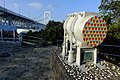 2016-11-12 Onarutokyo(大鳴門橋 鳴門岬側、大鳴門橋ケーブル断面模型・実寸)DSCF3804.jpg 2,304 × 1,536; 841 KB
-
 2016-11-12 Onarutokyo(大鳴門橋 鳴門岬側)DSCF3802.jpg 2,304 × 1,536; 859 KB
-
 2016-11-12 Onarutokyo(大鳴門橋 鳴門岬側)DSCF3805.jpg 2,304 × 1,536; 842 KB
-
 2016-11-12 Onarutokyo(大鳴門橋 鳴門岬側)DSCF3806.jpg 1,536 × 2,304; 830 KB
-
 2016-11-12 Onarutokyo(大鳴門橋 鳴門岬側)DSCF3822.jpg 2,304 × 1,536; 855 KB
-
 Admiralty Chart No 137 Harima Nada, Published 1876.jpg 10,880 × 16,205; 52.68 MB
-
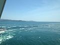
 Awajishima Island and Naruto Strait from Uzunomichi Promenade 1.jpg 3,264 × 2,448; 2.01 MB
-
 Awajishima Island and Naruto Strait from Uzunomichi Promenade 2.jpg 3,264 × 2,448; 2.17 MB
-
 Awajishima Island and Naruto Strait from Uzunomichi Promenade 3.jpg 3,246 × 2,435; 2.03 MB
-
 Awajishima Island and Naruto Strait from Uzunomichi Promenade 4.jpg 3,264 × 2,448; 2.21 MB
-
 Kameura Port.JPG 3,264 × 2,448; 1.82 MB
-
 Naruto strait aerial photo.jpg 2,059 × 1,544; 165 KB
-
 Naruto Strait from Ochaen Observation Deck in Naruto Park.jpg 3,264 × 2,448; 1.79 MB
-
 Naruto Strait from Uzunomichi Promenade.jpg 3,264 × 2,448; 1.98 MB
-
 Naruto Strait NASA WorldWind Outflow.jpg 1,024 × 658; 89 KB
-
 Naruto Strait near Kameura Port 2.JPG 3,185 × 2,389; 2.08 MB
-
 Naruto Strait near Kameura Port.JPG 3,264 × 2,448; 1.92 MB
-
 Naruto Strait near Kameura Tourist Port 2.JPG 3,242 × 2,431; 2 MB
-
 Naruto Strait near Kameura Tourist Port.JPG 3,264 × 2,448; 1.95 MB
-
 Naruto Strait near Ochaen Observation Deck in Naruto Park 2.jpg 3,264 × 2,448; 2.28 MB
-
 Naruto Strait near Ochaen Observation Deck in Naruto Park.jpg 3,264 × 2,448; 2.37 MB
-
 Naruto Strait Ōnaruto Bridge 1980 大鳴門橋工事(昭和55)Img352.jpg 3,413 × 2,279; 2.53 MB
-
 Naruto-Strait 1.png 1,156 × 873; 557 KB
-
 Oge Coast 20160505-2.JPG 3,145 × 2,359; 2.41 MB
-
 Oge Coast 20160505.JPG 3,221 × 2,416; 2.04 MB
-
 Super Liner Ogasawara 20110514.jpg 1,280 × 960; 352 KB
-
 The air corridor of the Uzunomichi.jpg 1,920 × 1,440; 646 KB
-
 The viewing platform of the Uzunomichi.jpg 1,280 × 960; 325 KB
-
 View from Uzunomichi Promenade 6.jpg 3,264 × 2,448; 1.95 MB
-
 View of Kameura Tourist Port.JPG 3,163 × 2,372; 2.13 MB
-
 Wonder-Naruto DSCN3024 20120503.JPG 2,048 × 1,536; 855 KB
-
 ジャンプ禁止 (4693129376).jpg 3,749 × 2,507; 1.8 MB
-
 鳴門 - panoramio.jpg 1,600 × 1,200; 923 KB
-
 鳴門海峡 - 沼島地図.png 1,358 × 941; 443 KB


.jpg)
