Category:Puchheim
city in Germany    | |||||
| Upload media | |||||
| Pronunciation audio | ⓘ | ||||
|---|---|---|---|---|---|
| Instance of |
| ||||
| Part of |
| ||||
| Location | District of Fürstenfeldbruck, Upper Bavaria, Bavaria, Germany | ||||
| Head of government |
| ||||
| Population |
| ||||
| Area |
| ||||
| Elevation above sea level |
| ||||
| Different from | |||||
| official website | |||||
 | |||||
Subcategories
This category has the following 13 subcategories, out of 13 total.
B
- Burgstall Parsberg (8 F)
C
D
F
- Fire Puchheim 2012-01-08 (6 F)
G
H
- Hausmüllverwertung München (15 F)
- Historic views of Puchheim (11 F)
K
N
- Nature of Puchheim (3 F)
P
S
Media in category "Puchheim"
The following 22 files are in this category, out of 22 total.
-
 An der grossen Mauken - panoramio.jpg 2,048 × 1,538; 721 KB
-
 Attnang-Puchheim - Ager - 2025 10 28.jpg 6,809 × 4,539; 8.83 MB
-
 Attnang-Puchheim - Eisenbahn - Betriebsbahn S. Spitz - 2025 10 28-1.jpg 6,960 × 4,640; 8.39 MB
-
 Attnang-Puchheim - Eisenbahn - Betriebsbahn S. Spitz - 2025 10 28-2.jpg 6,958 × 3,914; 7.95 MB
-
 Aubing-Lochhausen-Langwied, Munich, Germany - panoramio (4).jpg 2,048 × 1,536; 656 KB
-
 Brunnenpuchheim.jpg 600 × 800; 282 KB
-
 Bushaltestelle mvv.jpg 3,096 × 4,128; 2.01 MB
-
 DEU Puchheim COA.svg 512 × 707; 12 KB
-
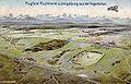 Flugfeld Puchheim (Illustration).jpg 807 × 517; 359 KB
-
 Franz hämmerle skulptur begegnung 1993.jpg 2,767 × 3,258; 6.41 MB
-
 Ikaros Gewerbegebiet Puchheim Bernd Stöcker 1994.jpg 3,730 × 2,757; 2.8 MB
-
 Maibaum in Puchheim-Bahnhof.jpg 1,536 × 2,048; 1.31 MB
-
 Oststelen Puchheim.JPG 3,072 × 2,304; 3.14 MB
-
 Puchheim Bahnhof - geo.hlipp.de - 37416.jpg 640 × 480; 95 KB
-
 Puchheim in ffb.svg 435 × 330; 103 KB
-
 Puchheim in FFB.svg 446 × 390; 976 KB
-
 Puchheim, Gedenkstein Städtepartnerschaften.jpg 2,015 × 3,105; 4.2 MB
-
 Puchheim, Germany - panoramio.jpg 2,048 × 1,538; 459 KB
-
 Puchheim, Rathaus.jpg 3,961 × 2,017; 4.9 MB
-
 Rathaus von Puchheim.jpg 2,048 × 1,536; 1.39 MB
-
 Siedlung Puchheim.jpg 4,284 × 4,504; 8.15 MB
-
 Wappen Puchheim.png 150 × 160; 8 KB


.jpg)


.jpg)


