Category:San Fernando Valley
English: The San Fernando Valley — in the Greater Los Angeles region, Los Angeles County, Southern California.
For the part of the Valley that is a region of the City of Los Angeles, see San Fernando Valley, Los Angeles.
For the part of the Valley that is a region of the City of Los Angeles, see San Fernando Valley, Los Angeles.
Español: Valle de San Fernando.
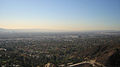
urbanized valley in Los Angeles County, California, United States  San Fernando Valley looking northeast; from the Top of Topanga Overlook Park above Woodland Hills in foreground The southeast San Fernando Valley from Mulholland Drive  Läge på Los Angeles-slätten. | |||||
| Upload media | |||||
| Instance of | |||||
|---|---|---|---|---|---|
| Location | Los Angeles County, California, Pacific States Region | ||||
| Mountain range | |||||
| Population |
| ||||
| Elevation above sea level |
| ||||
 | |||||
Subcategories
This category has the following 17 subcategories, out of 17 total.
Media in category "San Fernando Valley"
The following 88 files are in this category, out of 88 total.
-
 Woodland Hills vista.jpg 1,080 × 680; 371 KB
-
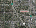
 Location map San Fernando Valley.png 690 × 655; 469 KB
-
 San Fernando Valley Los Angeles CA.jpg 1,931 × 1,086; 861 KB
-
 San Fernando Valley vista.jpg 1,152 × 643; 434 KB
-
 San Fernando Valley from Southeast Edge.jpg 3,228 × 1,776; 900 KB
-
De-San Fernando Valley.ogg 2.4 s; 23 KB
-
 San Fernando Valley all Hall Map 1880.png 1,055 × 661; 1.3 MB
-
 405 North Freeway San Fernando Valley - panoramio.jpg 3,453 × 1,818; 2.17 MB
-
 SSFL Aerial 2005.jpg 422 × 316; 196 KB
-
 ABDAG006978 - Wilson Silsby - San Fernando Valley, California.jpeg 800 × 439; 64 KB
-
 After The Rain - Flickr - Amy V. Miller.jpg 3,608 × 1,729; 1.83 MB
-
 Ari Bennett.jpg 2,773 × 3,024; 2.52 MB
-
 As we see 'em (184).jpg 4,703 × 7,159; 4.19 MB
-
 Briedges academy view from under tree campus.png 3,460 × 546; 2.53 MB
-
 Burbank.jpg 3,264 × 2,448; 1.71 MB
-
 California US Congressional District 28 (since 2013).tif 2,016 × 996; 3.04 MB
-
 California 29th Congressional District.png 517 × 607; 129 KB
-
 California US Congressional District 29 (since 2013).tif 2,016 × 998; 3.06 MB
-
 California US Congressional District 30 (since 2013).tif 2,016 × 998; 3.05 MB
-
 CA 30 certified.pdf 1,275 × 1,650; 801 KB
-
 California - Hollywood - NARA - 23934387.jpg 3,400 × 4,459; 7.89 MB
-
 LA Aqueduct Opening2.jpg 800 × 624; 185 KB
-

-
 Chatsworth Reservoir Kiln Site.jpg 3,264 × 2,448; 1.71 MB
-
 Cypress in Sunland California.JPG 3,000 × 4,000; 4.26 MB
-
-
 February 1971 San Fernando earthquake intensity USGS.jpg 612 × 711; 163 KB
-
 USGS Shakemap - 1971 San Fernando earthquake (alternate).jpg 864 × 792; 242 KB
-
 Universal Hollywood Panorama.jpg 1,000 × 552; 625 KB
-
 Universal Studios Hollywood 2012 55.jpg 5,184 × 3,456; 5.16 MB
-
 Universal Studios Hollywood 2012 56.jpg 5,184 × 3,456; 5.58 MB
-
 Universal Studios Hollywood Backlot 081807.jpg 3,072 × 2,304; 2.09 MB
-
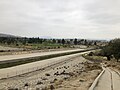 Hansen Dam spillway channel.jpg 4,032 × 3,024; 3.54 MB
-
 HANSENDAM2022.jpg 2,362 × 3,080; 6.6 MB
-
 Hollywood Freeway north of Cahuenga Pass - 2013.jpg 2,816 × 2,112; 2.14 MB
-
 Hollywood Split 101,134,170.png 820 × 655; 1.19 MB
-
 Incendios - panoramio.jpg 1,280 × 1,024; 197 KB
-
 James Boon Lankershim portrait circa 1900.jpg 2,266 × 2,832; 993 KB
-
 KVNY2021.jpg 3,512 × 2,351; 8.52 MB
-
 Logo of los angeles mission college.jpg 228 × 250; 10 KB
-
 Magnolia Character Relationships.svg 525 × 720; 150 KB
-
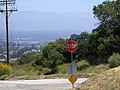
 Marvin Braude Mulholland Park.JPG 2,784 × 2,069; 1.15 MB
-
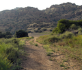
 Mountain Bikers at Marvin Braude Gateway Park.JPG 1,345 × 1,501; 459 KB
-
 Mulholland Drive (5465919454).jpg 5,184 × 3,456; 5.04 MB
-
 Mulholland Drive at night.jpg 5,184 × 3,456; 5.8 MB
-
 Mulholland Drive.JPG 576 × 432; 65 KB
-
 FEMA - 13698 - Photograph by Robert A. Eplett taken on 01-17-1994 in California.jpg 1,952 × 2,940; 3.74 MB
-
 Oak Crest Ranch Providencia Ranch.jpg 1,024 × 768; 856 KB
-
 Old Stagecoach Trail Santa Susana3.png 1,736 × 1,477; 4.85 MB
-
 Orange grove bothwell.jpg 527 × 480; 49 KB
-

-
 Oxnard-Thousand Oaks-Ventura, CA, CA, USA - panoramio - Greg V.jpg 2,560 × 1,920; 1.67 MB
-
 Poleras Batallar entre la Niebla.jpg 960 × 720; 98 KB
-
 Rand and O'Connor home in San Fernando Valley.png 1,192 × 1,122; 1.23 MB
-

-

-
 Reseda.jpg 700 × 575; 98 KB
-
 San Fernando Valley 12 16 2016 (188655481).jpeg 2,048 × 1,365; 645 KB
-
 San Fernando Valley from Mulholland Dr.JPG 8,934 × 1,614; 1.41 MB
-
 San Fernando Valley from Mullholland Hwy.jpg 3,929 × 1,637; 6.75 MB
-
 San Fernando Valley panorama from Mullholland Hwy.jpg 6,815 × 2,048; 20.27 MB
-
 San Fernando Valley panorama Woodland Hills.jpg 15,036 × 3,114; 5.18 MB
-
 San Fernando Valley panorama.jpg 10,816 × 1,416; 5.74 MB
-
 San Fernando Valley spineflower (39930058384).jpg 3,968 × 2,976; 2.97 MB
-
 San Fernando Valley, California LCCN2011634778.tif 6,234 × 4,433; 158.16 MB
-
 San Fernando Valley.jpg 2,048 × 1,536; 393 KB
-
 San Fernando vs Livermore map.jpg 2,777 × 2,233; 2.47 MB
-
 SMOG - NARA - 542581.jpg 2,002 × 3,000; 5.44 MB
-
 Ssfl cdc atsdr figure1.gif 701 × 531; 158 KB
-
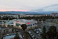
 Sunset over the San Fernando Valley (27221489472).jpg 2,000 × 1,333; 1.12 MB
-
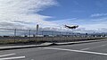 SWA1772 N945WN Burbank Airport landing.jpg 4,032 × 2,268; 2.14 MB
-
 The 405 in the Sepulveda Pass.JPG 3,264 × 1,602; 1.38 MB
-
 Universal City from Briar Summit.jpg 4,000 × 3,000; 5.32 MB
-
 UNIVERSAL STUDIOS SEEN THROUGH SMOG - NARA - 542580.jpg 2,005 × 3,000; 5.18 MB
-
 USGS - Sierra Madre Fault Zone.gif 214 × 218; 17 KB
-
 Ventura County Line Graffiti.jpg 4,032 × 2,268; 2.7 MB
-
 VIEW OF SMOG FROM UNIVERSAL CITY HOTEL - NARA - 542579.jpg 2,047 × 3,000; 3.59 MB
-
 View of the Valley from The 405.JPG 2,463 × 1,657; 1,006 KB
-

-
 Warner Center Shuttle.jpg 4,032 × 3,013; 2.87 MB
-
 Westfield Promenade mall sunset.jpg 4,116 × 2,424; 2.48 MB
-
 Westfield Promenade mall vista.jpg 3,647 × 2,464; 1.67 MB
-
 Woodland Hills morning.jpg 2,701 × 2,109; 1.88 MB
-
 Golden State Freeway.svg 1,152 × 640; 235 KB
-
 Ventura Freeway.svg 1,152 × 640; 235 KB
-
-
 עמק סן ברננדו.jpg 1,600 × 1,200; 605 KB
-
 Newhall Pass Interchange.png 1,134 × 2,707; 8.05 MB


.jpg)


.jpg)


.jpg)


_(14573539970).jpg)
_(14780102663).jpg)

.jpeg)

.jpg)


.jpg)


